#4—Panoramic Hills
Walk #4—Panoramic Hills
Saturday, 4 August 2012
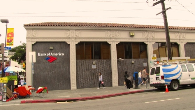
It was overcast and 59F when we started out in front of the Bank of America’s Southside branch on the corner of Durant and Telegraph. In 1970, a branch of the same bank near Santa Barbara was burned to the ground by students at the University of California, Santa Barbara. The high windows in the this Berkeley branch (UC Berkeley is a block away) were then covered over. It was only a few years ago the bank exposed the windows again!
The first stretch of the walk is up Durant, to the right.
This is a map of the walk (salmon pink color). You can enlarge it to see the staircases and paths, and switch to other views (eg, satellite) to see the area differently. Street view is also available. The blue pin is the start of the walk. The gray line in the map (just off to the right) is the boundary of the two cities.
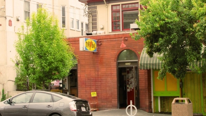
Up a bit on the right side of Durant is the locally–famous Top Dog. The hot dogs are good, and there is always something political to read!
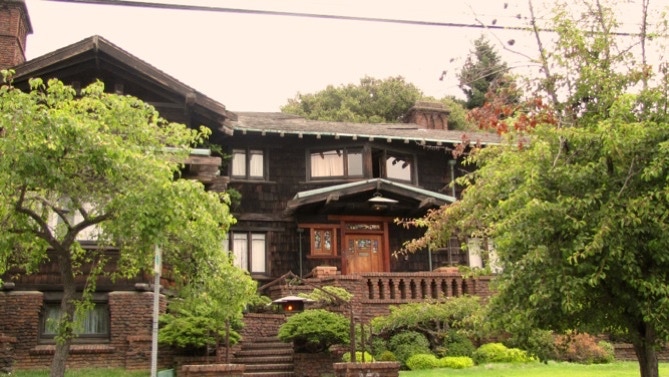
After turning left at the end of Durant Avenue, we came across the only Greene and Greene house in the East Bay, according to the 41 Berkeley Walking Tours book (Tour No. 25). It dates from 1908.
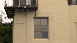
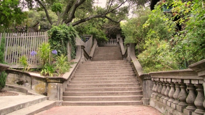
Then it’s up Bancroft Way, past the International House (which generally looks better the farther one is from it) to the Bancroft Steps. There are lots of sororities and fraternities in this area. Alpha Phi’s entrance is on the Steps.
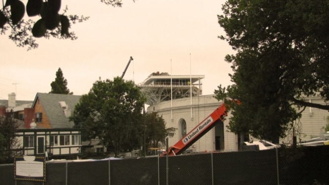
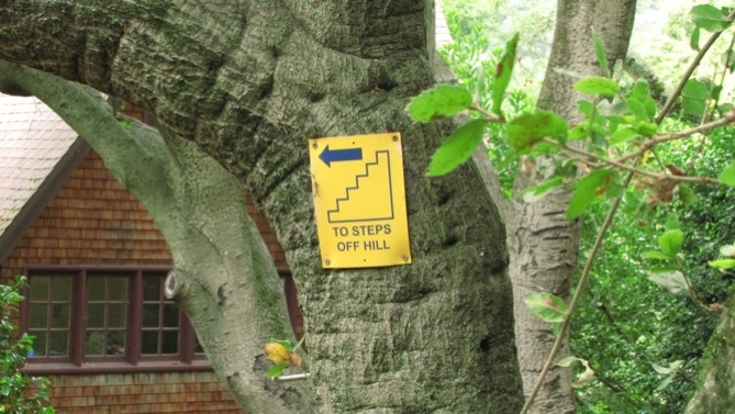
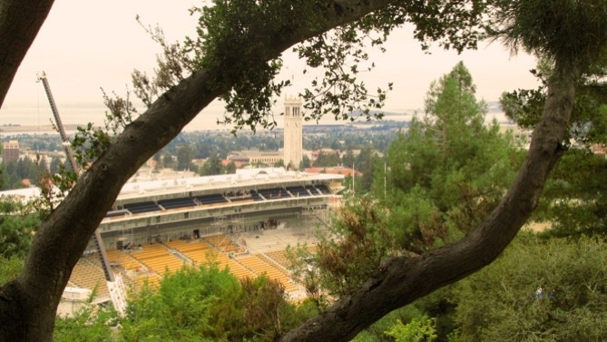
At the top of the Bancroft Steps we ran into the construction mess of Memorial Stadium. A short right and then left onto Prospect Street brought us to this curious “HM” road sign.

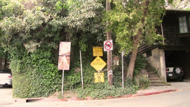
Our best guess is the sign means no hazardous materials to the right, on Panoramic Way. Which makes sense, since the signage includes “Sharp Curves Ahead” and “Impassible for Large Trucks” and, besides, there is “No Outlet” on the “Narrow” road.
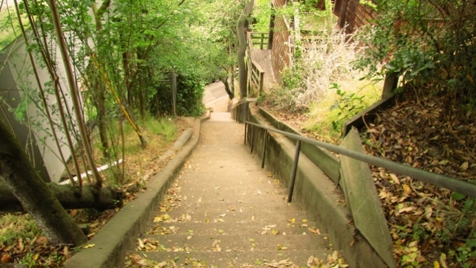
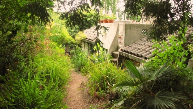
And off to the right, up Panoramic, we walked to the bottom of Orchard Lane, built in 1910. Panoramic Hill’s steps get a good write up here.

After reaching the top of Orchard Lane’s steps, we swung left around the curve and went up the second section of Orchard Lane. The home at #3 has its entrance on the left.
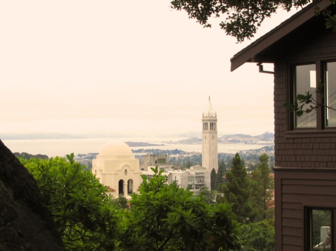
The view back to the west is getting more interesting. Here’s the Campanile and the top of International House.
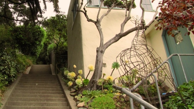
Nearing the top of Orchard Lane, there is this nice garden of succulents, a wire giraffe and a face in the door’s window.
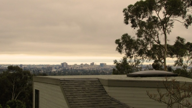
Here’s the map again. We’re now at the red pin, at the intersection of Orchard Lane and Arden Road. After turning left onto Panoramic Way, the views of downtown Oakland are good. Too bad it’s not a sunny day.
The road gets steep after the hairpin turn (page 34 in the book). The top of Arden Path is easy to spot, and down we go to Arden Steps. Berkeley homes often have a collection of trash cans out in the street. Right around the corner, on Arden Road, is this nice looking staircase up to the house at #100 (page 34 in the book, built in 1915).
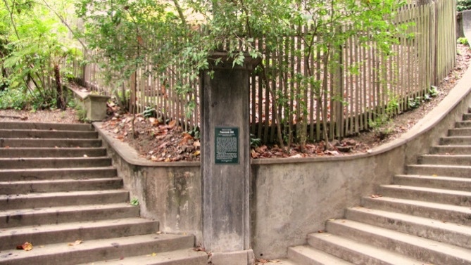
At the bottom of the Arden Steps is one of the emergency signs noted in the book (bottom of page 34).
Another picture of the work going on at Memorial Stadium.
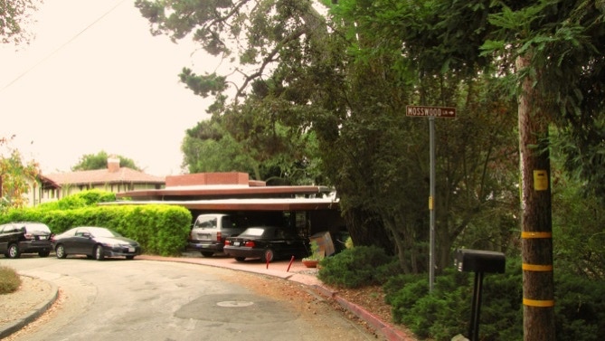
Walking along Mosswood Road to the entrance to Mosswood Lane. The Frank Lloyd Wright designed home is in this photo (page 35 in the book).
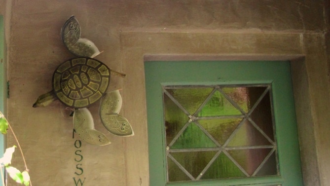
Near the bottom of Mosswood Lane is the Fabricrete home of the man who invented Fabricrete, Walter Steilberg (page 35). His green tiles are there, too, plus a turtle at the front door.

Not far off is the intersection of Mosswood Lane and Orchard Lane. We had gone up the stairs on the right, and just came down the ones on the left. We’re headed for Bancroft Way now.
At College Avenue and Bancroft Way, here is the building that used to house the restaurant Adagia (page 35). It’s a burger place now.
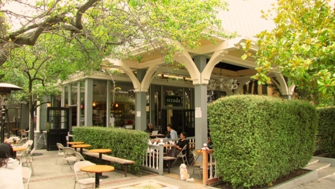
Across the street is Strada, a coffee house that has been in business a long time. We went down College and turned right on Durant.

That’s an 8 story redwood tree over at College and Durant. That’s Freeborn Hall, built in 1958.
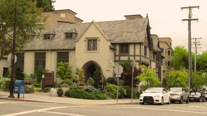
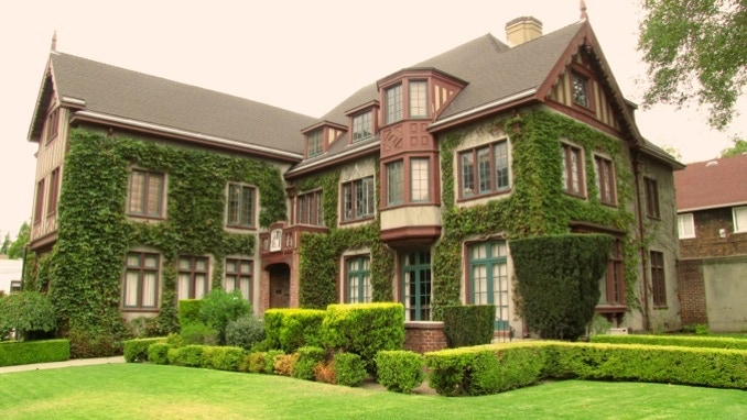
Here’s a fine looking home (now a fraternity) at the same intersection. It was built in 1916 and was featured in the movie “The Graduate.”
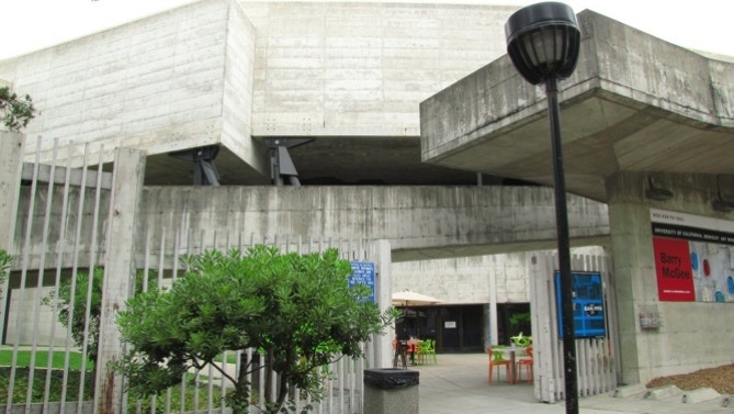
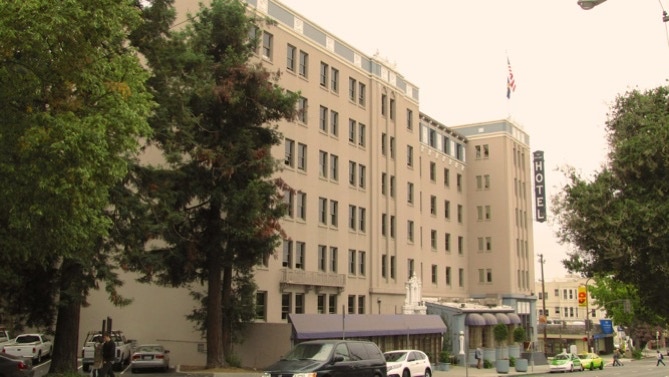
Down Durant there is the the University Art Museum, a concrete wonder from the 1960s, and the Durant Hotel, built in 1928.
And that’s it, past the Top Dog and back down to the Bank of America. Here’s the map again.
This walk is in an area along the “southside” of the University of California campus, and then up into the hills above it. All of the walk is in Berkeley.
The book reports 504 steps and 2 miles. The step count and the distance look right. (distance calculated by Google maps).
Next—Campus Walk, on the University of California campus.