
#5—Campus Walk
Walk #5—Campus Walk
Saturday, 11 August 2012
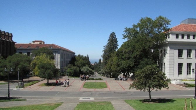
It was sunny and 68F when we started out in front of the circular driveway at the intersection of Oxford Street and Addison Street.
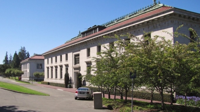
The first stretch of the walk is up through the middle of the circle. The building mentioned on page 37 (Center for Biomedical and Health Sciences) is now open for business.
This is a map of the walk (gray color). You can enlarge it to see the staircases and paths, and switch to other views (eg, satellite) to see the area differently. Street view is also available. The blue pin is the start of the walk. The other three color lines represent other walks in the book.
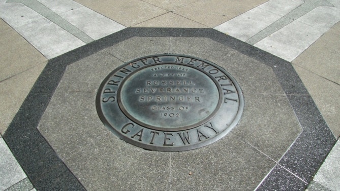
We’re entering the campus via the Springer Memorial Gateway (and stairway). Flash is needed for the link.
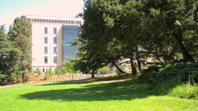
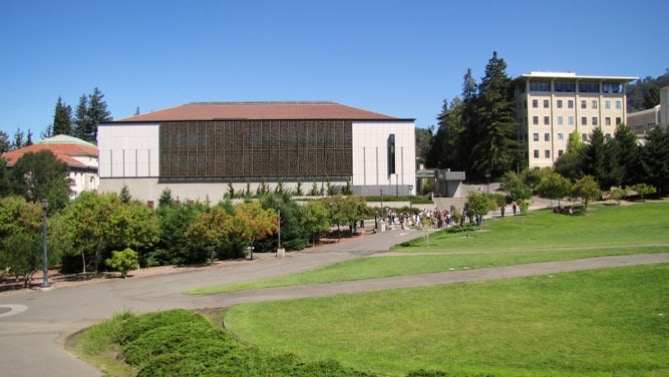
Here’s the “huge old eucalyptus tree” mentioned on page 38 in the book. The modern annex of the Valley Life Sciences Building is just over on the right.
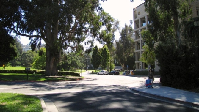
There are not many people walking around today: school doesn’t start for another two weeks.
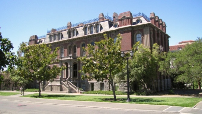
The older part of the LSB is quite distinctive.
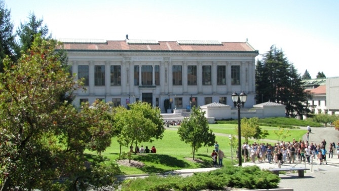
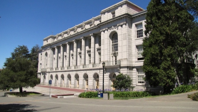
After working our way up to the Main Library, a look back at California Hall (1905). Flash needed.
The Main Library (Doe) is one hundred years old. Looking across the grass in front of the entrance, you can see the East Asian Library. That looks like a group of new students getting a tour.
On page 38, Mr Fleming reports the campus was naturally flat, and now is on a man–made slope to give the area character. This seems odd, because the off–campus landscapes to the north and south are definitely on a slope.
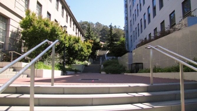
Just before we climb the “peculiar funnel–like” staircase in the East Asian Library building (page 39) we looked back at the Doe Library. There is a large set of shelving for books under the grass. There’s the tour for new students.
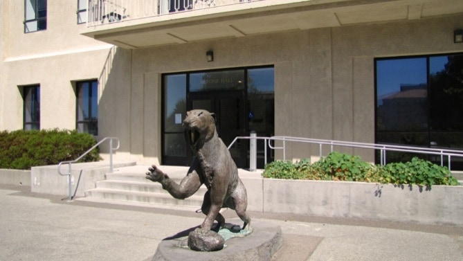
After climbing those stairs, we turned around McCone Hall and came across Trader Vic’s saber tooth tiger (page 39). It’s definitely modern.
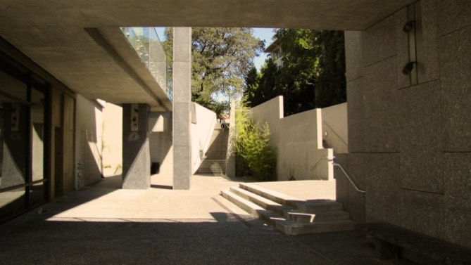
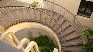
Here is the nearby circular staircase and the “strange industrial space” mentioned on page 39. Very sterile.
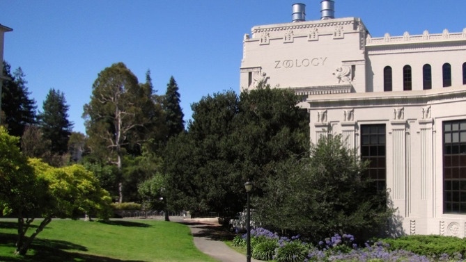
That slab–like building is Davis Hall, the home of civil engineering. The book recommends going inside; definitely interesting if the doors are unlocked.
Here’s the map again. The saber tooth tiger is the cocktail glass pin.
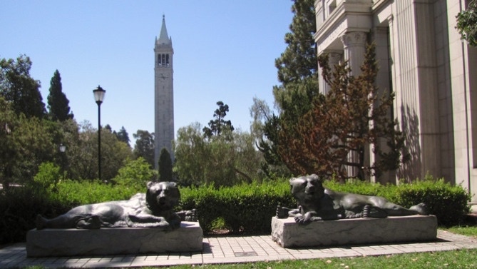
Here are the “lounging bronze bears” mentioned on page 39. The clocktower in the photo is Sather Tower, perhaps better known as the Campanile.
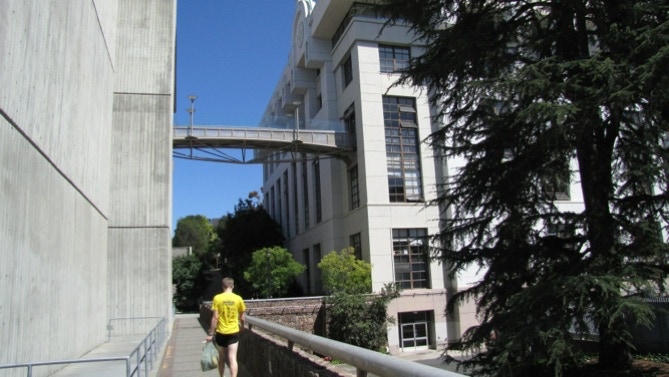
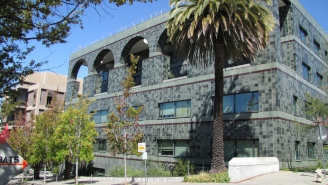
Here’s the “imposing glass catwalk” between Cory and SutardjaDai Halls. (page 40). The Center for Information Technology Research in the Interest of Society is here.
Up on Hearst Street is Soda Hall (computer science). And then on past the “beautifully–maintained timber frame building” (Goldman School of Public Policy) mentioned on page 40.
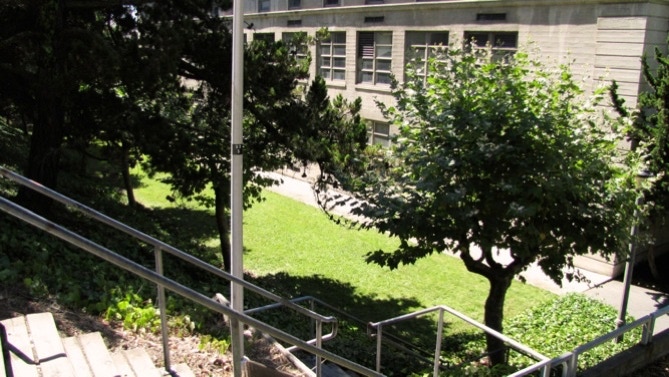
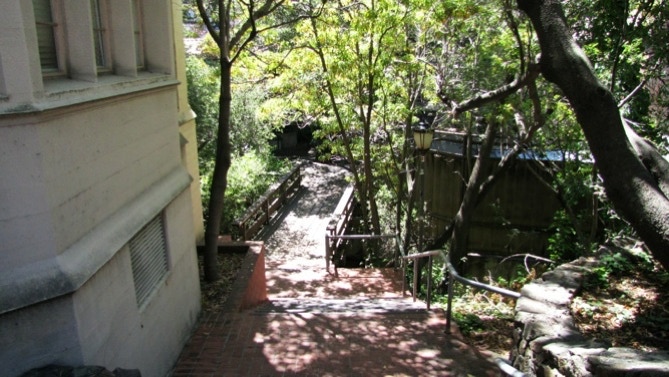
Continuing uphill and right around the corner (onto Gayley Road, not La Loma, as stated in the book) there’s another staircase down, and a walk past Donner Laboratory. Then a staircase back up to Gayley Road.
Here’s another staircase down, just past the intersection with University Drive.
Not long after, we came across this sign about parking. Here’s a link about the Nobel Prize winners at Berkeley. We are at the P pin on the map.


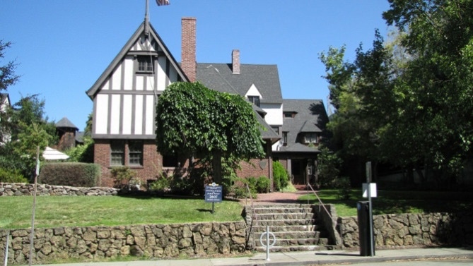
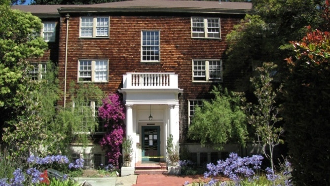
Here is the front of the Women’s Faculty Club (1923, designed by John Galen Howard). In the linked document, make sure to look at “Works.”
This is the log cabin noted on page 41. Will it be standing after an earthquake?
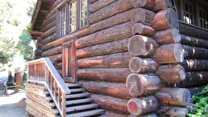
At this point, we are not sure if we are on the right path or not. This is the far end of the log cabin, which has the only door, and taking a right turn ahead doesn’t reveal a bridge. We didn’t notice a path around the near side of the log cabin. What we decided to do is turn left ahead (by the yellow tape by the tree) and walk alongside “The Faculty Club.” It seemed like the right thing to do.
Anyway, here’s the back side of The Faculty Club, with Strawberry Creek behind us. The Faculty Club was designed by Bernard Maybeck.

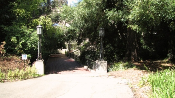
This is the “strange concrete stair–bridge” mentioned on page 41. The Hearst Family has had a tie with the University of California for more than a century. Remember Patty?
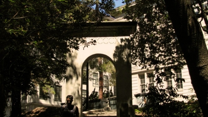
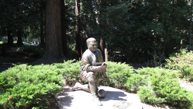
Eventually, after crossing the creek again we saw the statue of “Pappy” Waldorf (not Poppy) and the two decorative lanterns mentioned on page 42. We walked between the lanterns and up the steps of Stephens Hall.
After coming outside of Stephens Hall (at the top of the stairs) we were close to the Campanile.
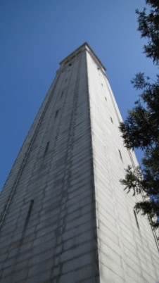
The structure is also known as Sather Tower. It is 307 feet tall, and its 61 bells are played several times a day, plus they announce the hours.
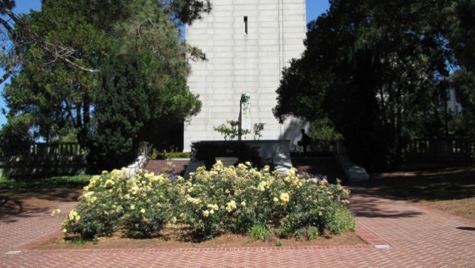
On Lincoln’s birthday (February 12), special music is played. There is a bust of Lincoln down near ground level.
This is the view west from the Campanile. On a day without fog, the Golden Gate Bridge is easily visible. But not today. On the left is South Hall.
South Hall (1873) is the oldest building on the campus.
We went around the right side of the building and along its back. Then we went down another flight of stairs over the creek, and on to the Mosaics.

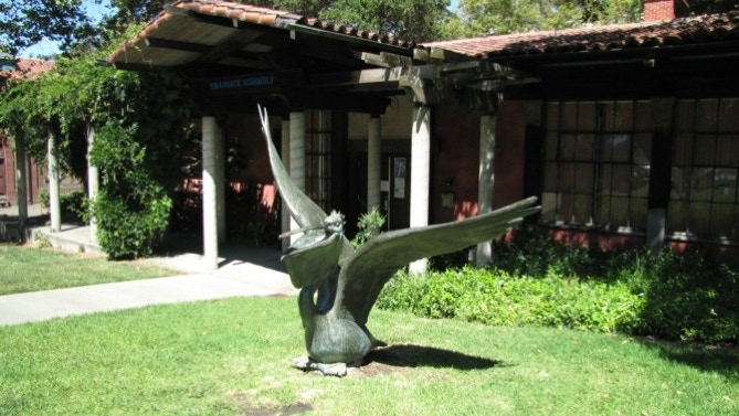
Here is the map again. We are at the yellow dramatic masks pin.
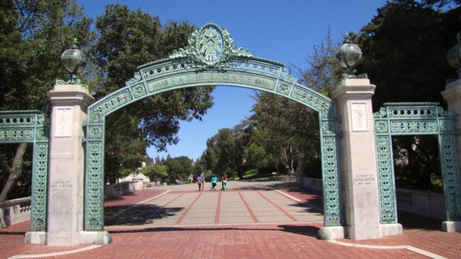
We walked past the Pelican Building, and downhill past giant Wheeler Hall, and on to Sather Gate. The Free Speech Movement started not far from this bridge over the creek.
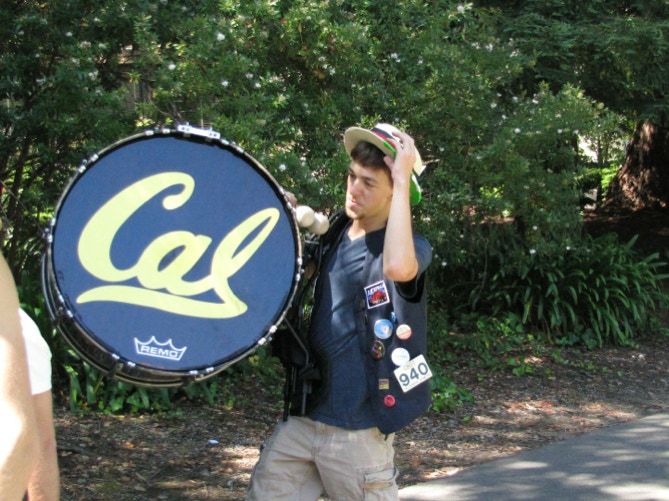
We continued downhill, along the creekside. In the distance was the sound of a band. Sure enough, into view came the Cal Marching Band. Here’s the drummer.
We emerged from the creek’s shadows by the opposite side of LSB.
Then back into the shadows, following Strawberry Creek back down to Oxford Street, and the end of the walk. Before getting to Oxford, though, the book (page 43) mentions Edwards Stadium and states it was “the original Cal football stadium....” That surely is incorrect. First, Edwards opened for business in 1932 as a track stadium. That’s interesting in light of the fact that Memorial Stadium (see Walk #4) where the Bears play football, opened in 1923! What we have not been able to find out is where the Bears played football before 1923. If you know, send us an email.
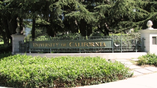
This walk is on the campus of the University of California.
The book reports 613 steps and 2.6 miles. The step count looks right, but the distance is about 2.3 miles. (distance calculated by Google maps). For those taking a bus to the start of the walk, there are other bus lines that operate in the area. See AC Transit’s map and schedule page.
Next—Holy Hill, just to the north of the University of California campus.
