Atacama, Part 2
Tuesday, 9 March 2010
After becoming somewhat used to the altitude during our first two days in San Pedro, we moved on to higher altitudes. The first day we drove south and then east, up towards the Sico Pass and the border with Argentina. The last day we drove east up towards the Jama Pass, also on the way to Argentina.
First, the Sico Pass highway. We backtracked a bit south towards the turnoff to Laguna Chaxa, and then hit new territory. The paved road ended at Socaire, a small village, and we had gravel all the way up to 13,000 feet and the Salar de Talar. One of the things that struck us was how little traffic there was on the highway; perhaps we’d pass an oncoming vehicle once every 20 minutes or so. Another thing was that the sun laughed at my sun block lotion.
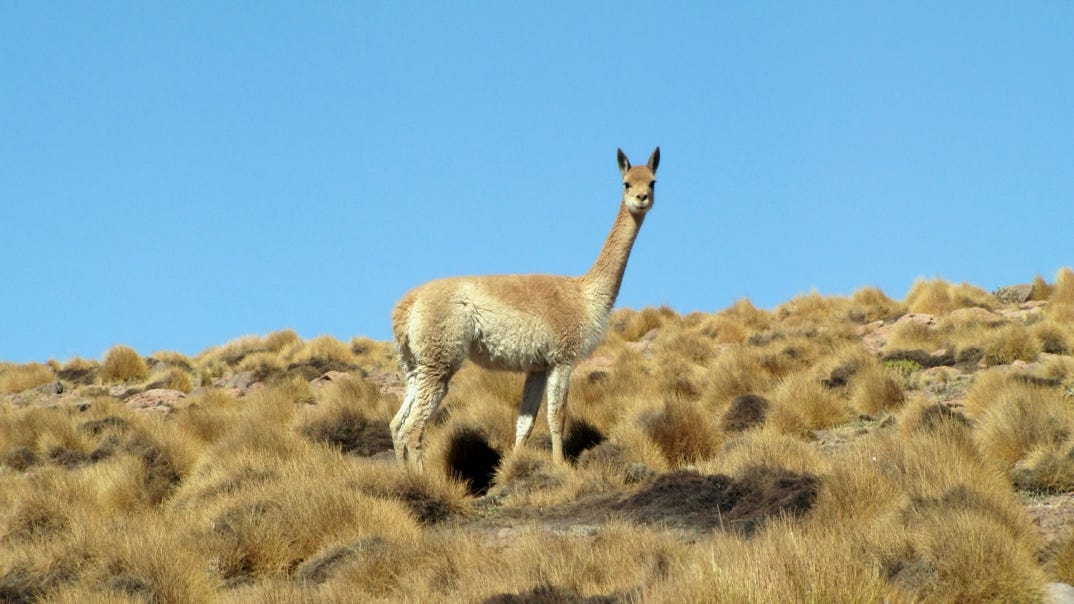
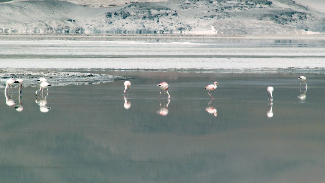
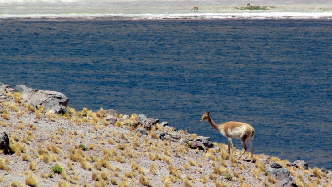
Along the way we saw vicuñas and more flamingoes.
Two years ago I asked our guide in Argentina, “what is the difference between the altiplano and the puna?” I was told it was the same thing, but depended on which country you were in. Our current guide gave another answer, which builds on the earlier one. Puna is the native word for what the Spanish called Altiplano.
All of the Jama Pass highway is within the tropics; no palm trees, though.
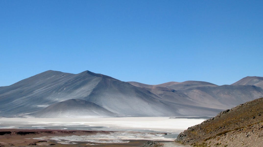
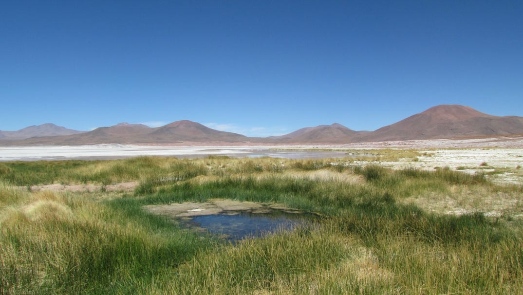
This photograph of the Salar de Talar looks like the moon, but the area is so big, if you look around, the landscape changes; elevation here is 13,000 feet.
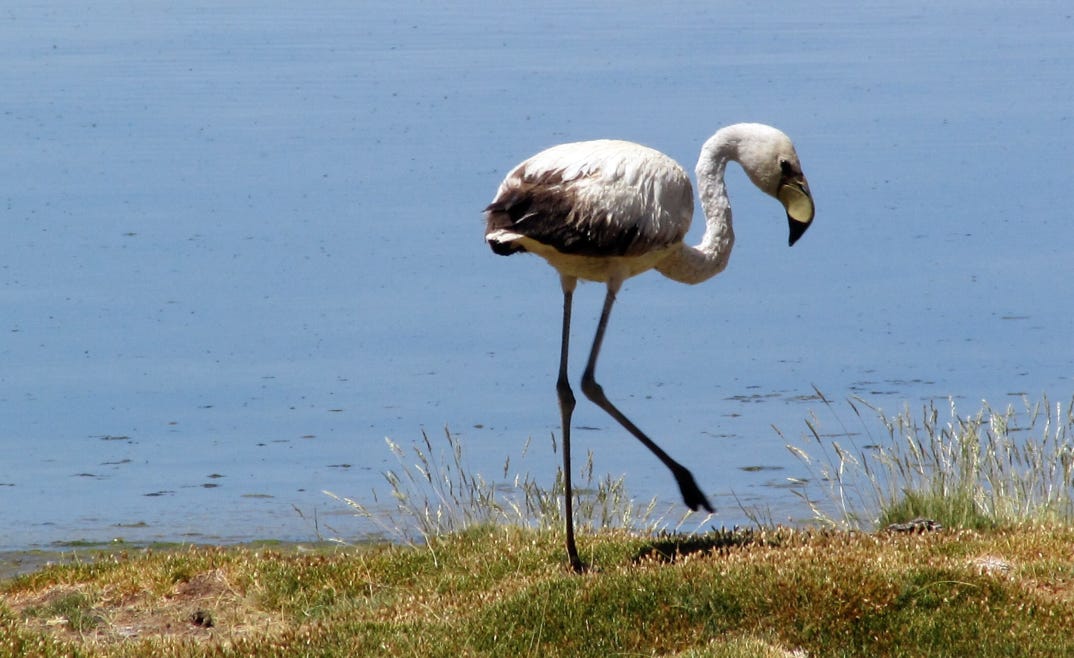
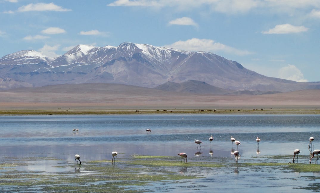
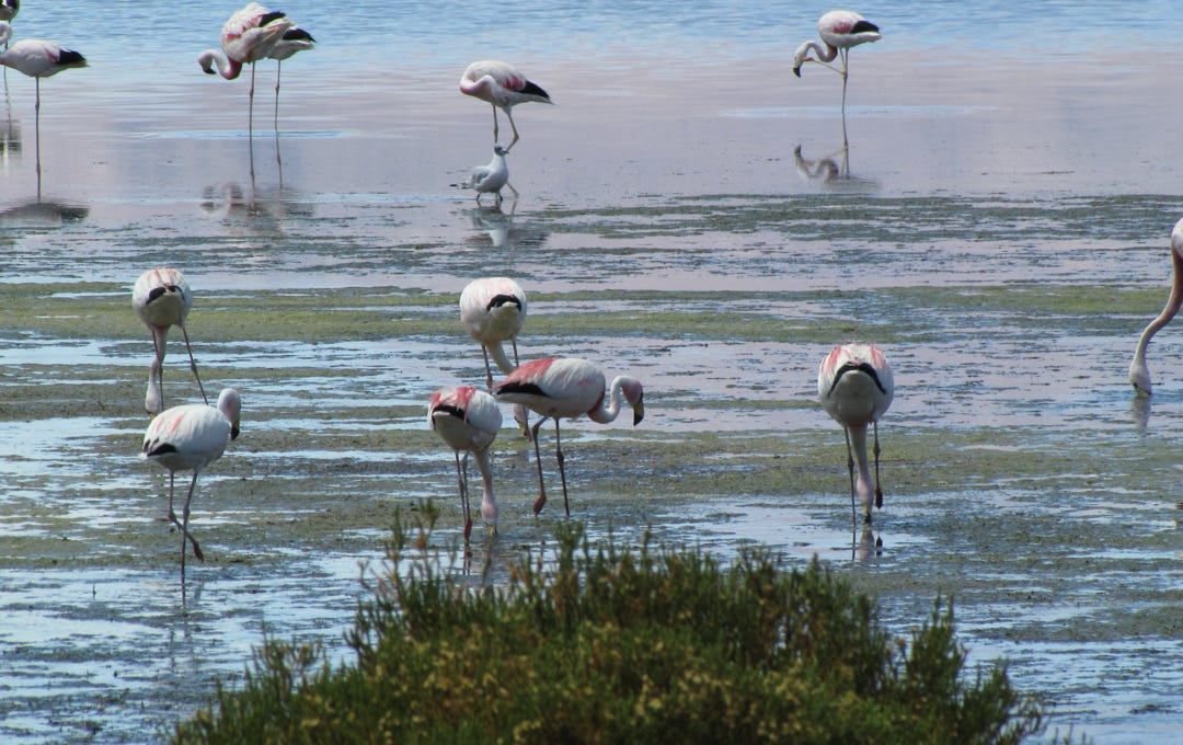
Where there is water, there is animal life, here two species of flamingo. The reflections of each bird in the water looks like a mirror. These pictures are at Salar de Talar.
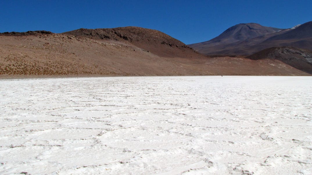
If you recall the very rough surface of the Salar de Atacama, below is another salt bed in the Altiplano—very different texture.
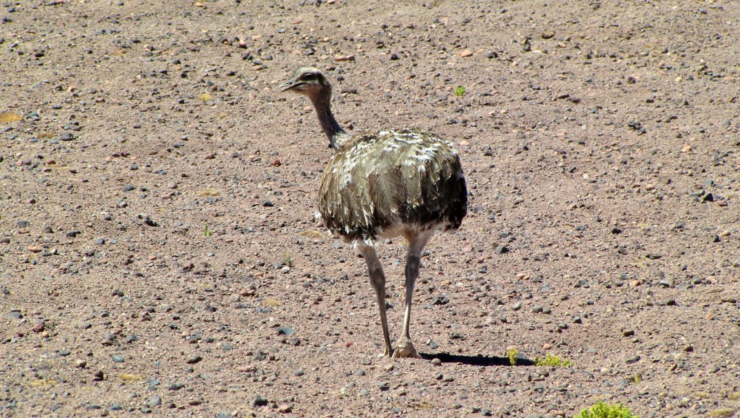
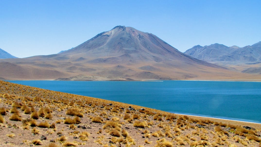
At this point, we turned around and headed back for the two salt lakes around the Miñiques volcano for a lunch break. Along the way we saw a rhea, a giant, flightless bird.
At the two salt lakes (Miscanti and Miñques) we saw vicuña. Elevation, about 14,000 feet.
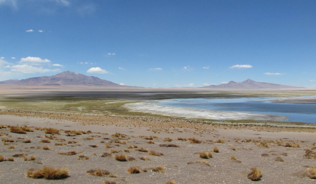
Below is what a salty lake (Laguna Miscanti) looks like, versus a salt flat.
After lunch we headed back down to San Pedro de Atacama. No oxygen problems so far.
The next day we headed up the other big highway, which is paved all the way across into Argentina. This road had more traffic, but not a lot. Car transports heading to Paraguay and Bolivia were the most prominent. This is the same highway we drove on (past Susques) two years ago, but on the other side of the border. The map does not show any towns (or gasoline) between San Pedro and Susques, which are 175 miles apart.
On the map below, the Sico Pass highway is in blue and the Jama Pass highway is in yellow.
More spectacular scenery, with decomposing rock, on the way to 14,100 foot high Salar Tara.


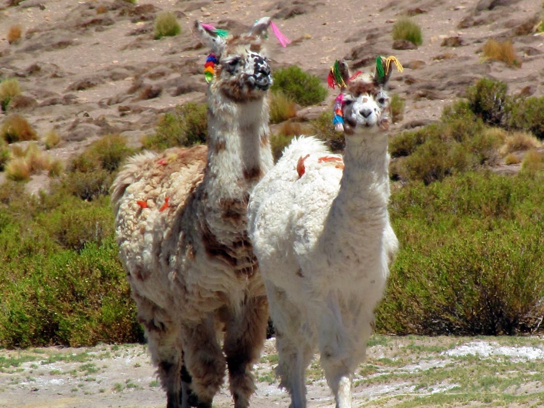
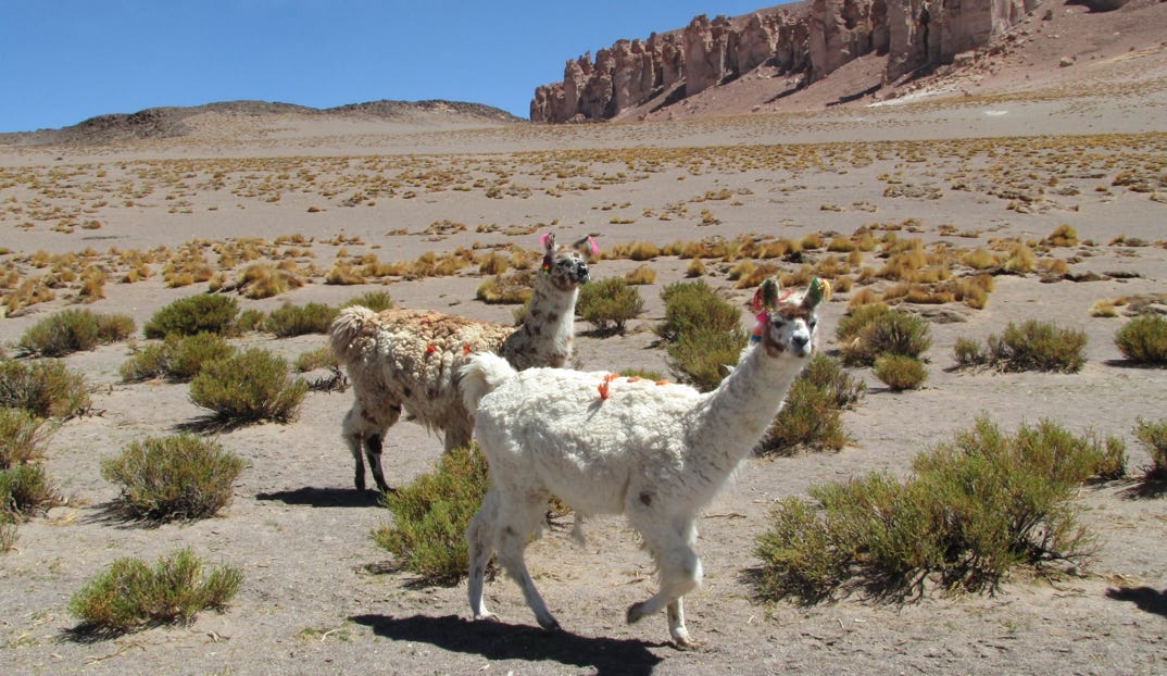
Unlike untamable vicuñas, llamas are domesticated and tagged for identification. And we saw more flamingoes.


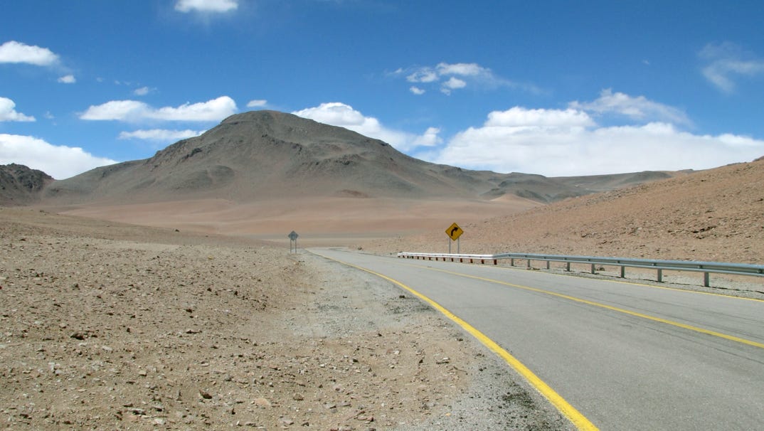
Here is a view of the highway up at over 14,000 feet; at one point we were at 15,800 feet.
On the way back down, the car’s engine stopped. Thankfully, another car from our hotel was an hour behind us, and we climbed into one vehicle and shared a ride back down to San Pedro de Atacama.
Now that we have adjusted to the altitude, we can go up higher to see the Altiplano.
Next—we have rented a car and will drive around Calama, and then on to Iquique, about a 5 hour drive. From there, we will try to reach the border with Bolivia to see Isluga National Park, reportedly infrequently visited.