San Pedro de Atacama
Sunday, 7 March 2010
We cancelled our tour in Puerto Varas today and spent time working on finding a replacement flight to Santiago (the airline schedules being disrupted by the earthquake). After getting a flight our of Puerto Montt (yay) and spending the night in Santiago, we went back to the airport (successfully operating out of tents, due earthquake damage to the terminal building) to board a plane for the 750 mile ride north to Calama. Here’s the track from Puerto Montt to Calama.
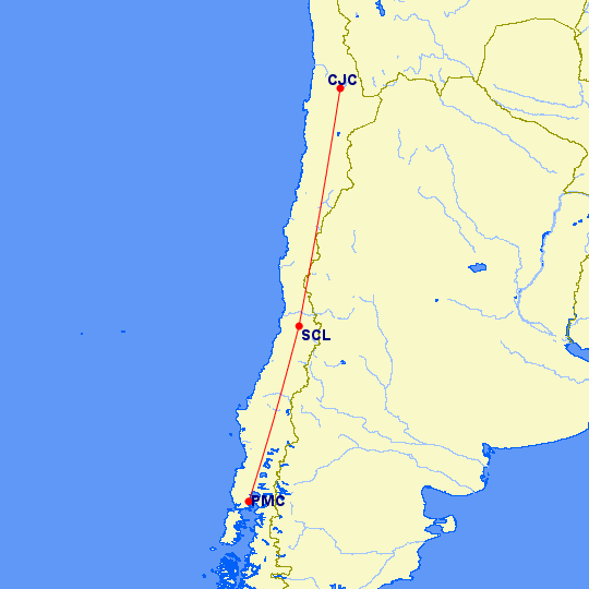
Calama is up near the border where Chile, Bolivia and Argentina come together.
We were picked up at the airport and took a car 60 miles south east to the little village of San Pedro de Atacama, our base for the next four days.
San Pedro is about 8,000 feet up, and the first two days were spent doing things at that elevation. The second set of two days will be spent higher up, after we adjust to the altitude. Early in the afternoon, we visited the local museum, which was quite good.
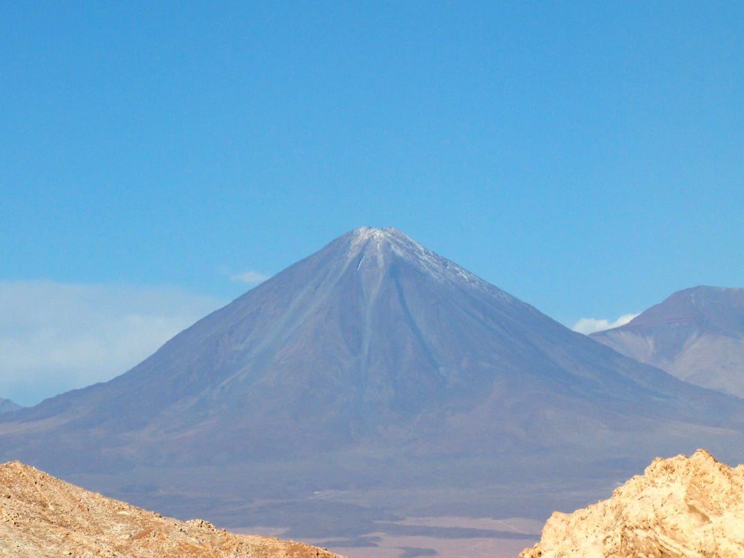
On our first two days we saw several villages, a giant salt flat, a lot of rock and sand, and where there was water, agriculture. Also, at one point we could see 30 volcanoes along the horizon, with at least two putting out steam. The visibility was so good we could see Llullaillaco, a 22,000 foot volcano (see Jama Pass Highway, 2007) for more.
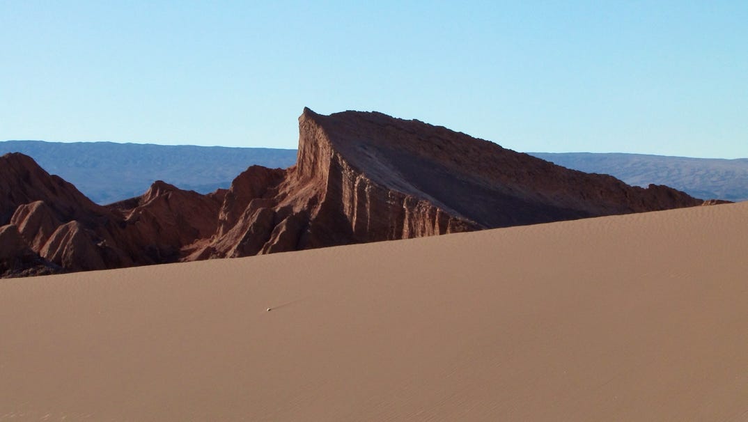
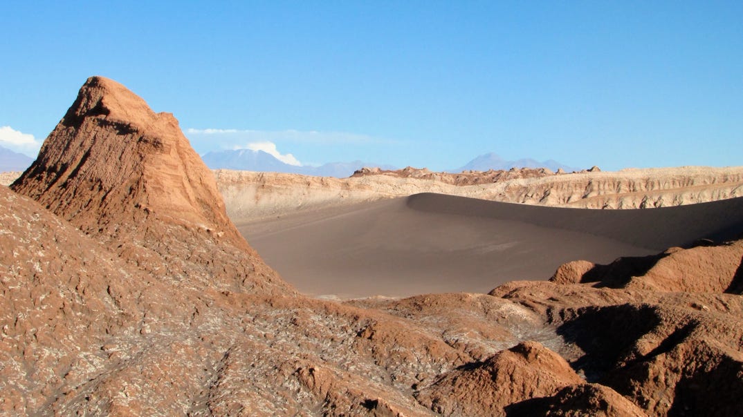
The first field trip was to the nearby Valle de la Luna, with lots of rock and sand. It was also clear right away that photography here depends a lot on the angle of the sun, and the difference between light and shadow was stark.

Above, badlands; below, lots of sand.
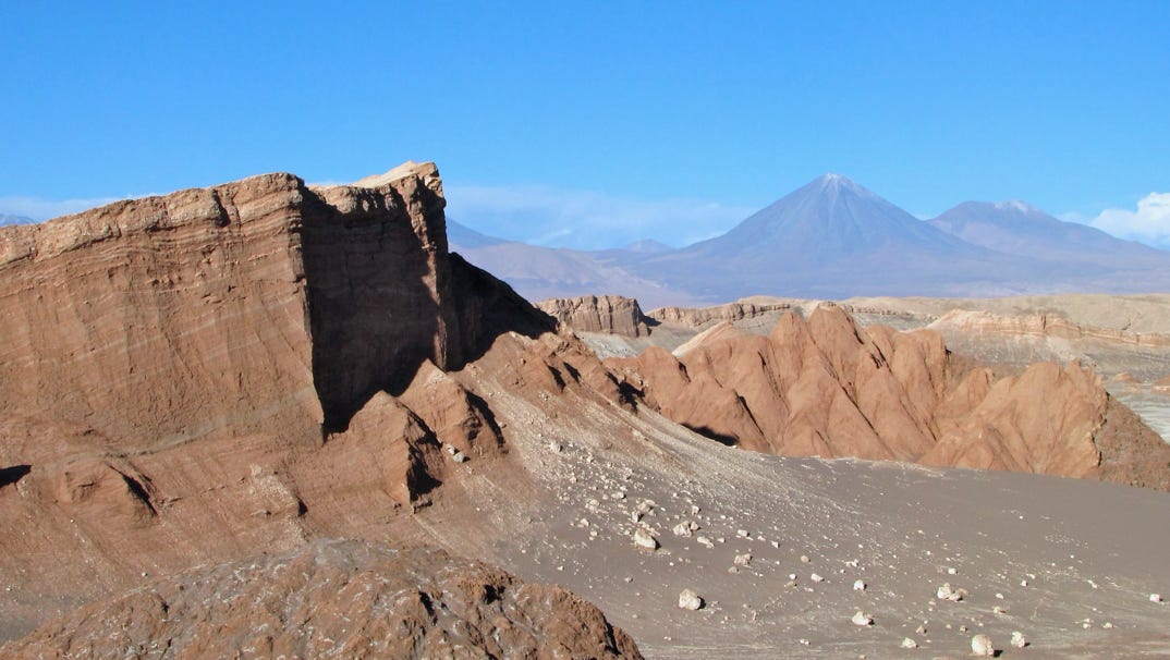
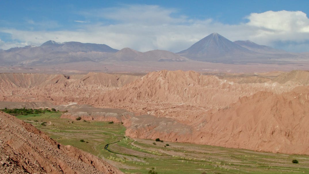
Below show the combination of rock and enormous sand mountains, some looked hundreds of feet high. The most prominent volcano (Licancabur) is on the horizon is on the boundary with Bolivia. It is 19,400 feet high.


The maps available on the internet for this area have errors, especially in the location of highways. The map below shows the locations seen during the first two days in San Pedro de Atacama.
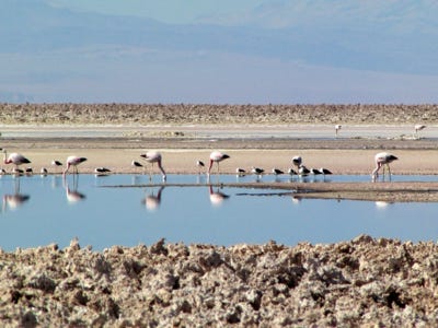
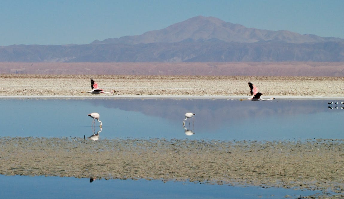
The next morning we set off for the Chaxa Lagoon out in the middle of the Atacama salt flat, passing through the village of Toconao on the way.
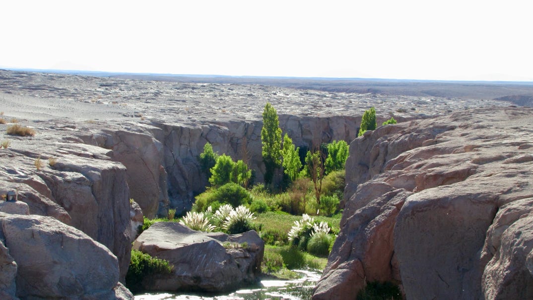
If there is a village, no matter how arid the surroundings appear there must be water. Here is a view of Jere Creek flowing down into Toconao.
The church in Toconao was built about 1750. Soon we were out in the salt flat, one section of Los Flamencos National Reserve. Sure enough, there were flamingos.
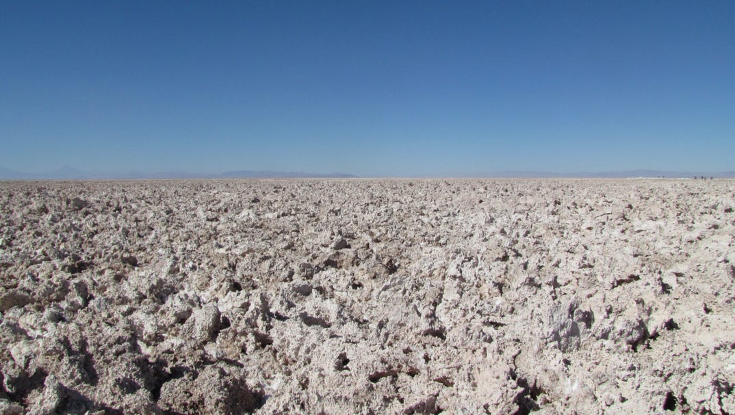
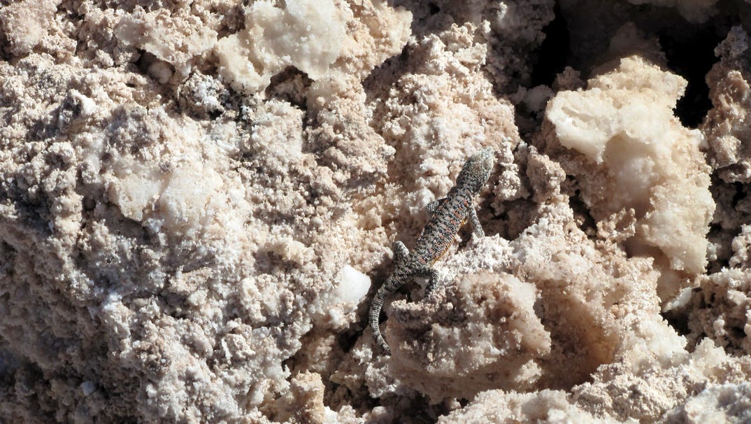
This salt flat is rough, and goes on to the horizon in every direction. We were told that animals besides birds live out here. Like this lizard. Who would have guessed?
Late in the afternoon, we went on a short drive north of San Pedro to begin a walk along a ridge back towards the village. When we were nearly done with the walk, we were 300 feet or so above the road, and the only way down is on a very steep slope. Of sand. So it was like walking with jets in our shoes.
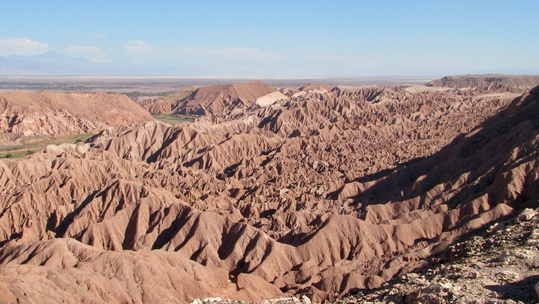
Early in the walk we saw remarkable bad lands.
Here is a look down at the stream that provides water to San Pedro.
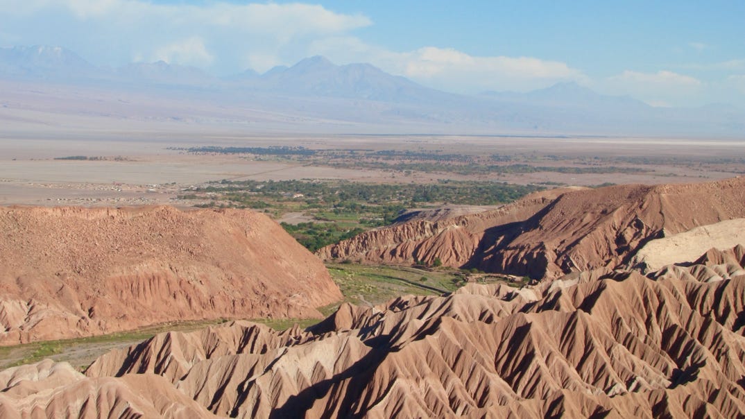
The stream moves on the the village, an oasis of green in the desert. From what I heard, San Pedro de Atacama is not a sustainable proposition. It is no longer just a small farming village, but has at least a half dozen “big” hotels, each using a lot of water pumped from wells. See it while you can.
We arrived at Calama Airport and drove about 60 miles southeast to our base at San Pedro de Atacama. We are to spend four days here.
Next—the Sico and Jama Pass highways, both way up on the Altiplano.