
Calama & Iquique
Thursday, 11 March 2010
The plan was to drive from Calama to Iquique up highway 5, and then swing west and down to the Pacific at the city of Iquique. Then the next morning, to get up and drive east all the way to Bolivia, to see the Isluga National Park.
Our car was pricy, a Toyota SUV with four wheel drive. That’s because the maps of Chile are not really very helpful. One map we had showed a town a distance to the north of the highway, and on the other side of the same map, in an enlargement, the town was some distance to the south side of the road.
So, taking no chances, we got the big car with the high clearance, even though we were assured the highway was paved all the way to Bolivia. Oh, and we were advised to get gas in Huara, the last place it was available.
First, though, we drove 50 miles out to the east of Calama to look at the villages of Caspana and Chiu Chiu. The drive on the gravel highway out to Caspana was an eye opener. The area is of course dry, but about all that can be seen are rocks. And mines. There were small mines scattered all over. It must be a fabulously rich area for miners. Calama, population about 140,000, is a place where someone walking down the street with an orange safety vest and a hard hat swinging from a belt is not an uncommon sight.
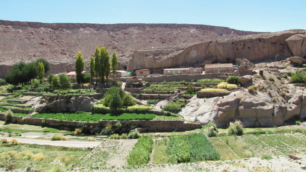
Caspana turned out to be like other villages we had seen elsewhere in the area. A long way from anywhere, but with water.
Here you can see that the village is down in a canyon, with terraces to grow crops.
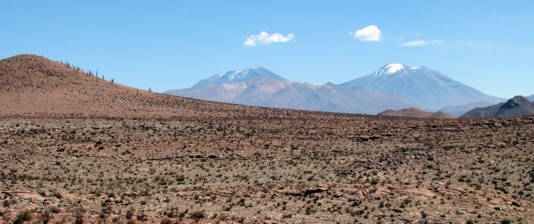
Some cactus can be seen on the hill. The volcano on the right is Lascar, and it is the most active volcano in northern Chile. It puffed out steam each day we were in San Pedro. 18,300 feet in elevation
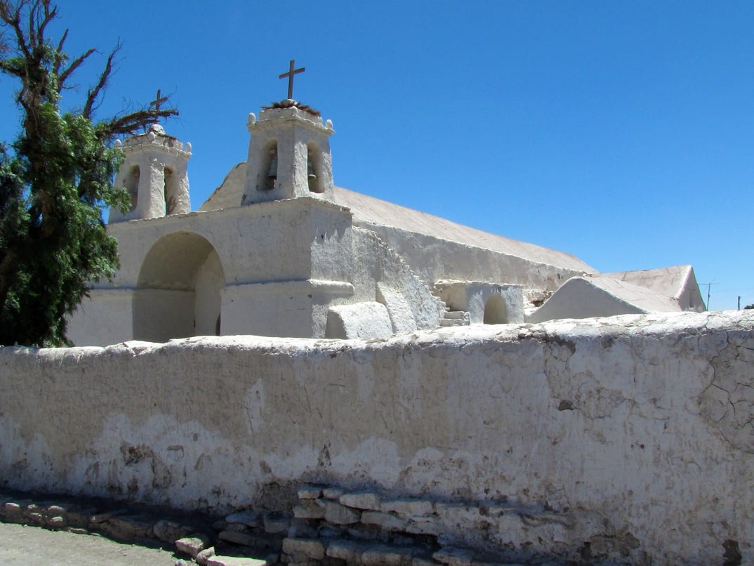
On the way back to Calama, we detoured to Chiu Chiu. It has the oldest church in Chile, built in 1540. The (locked) doors are made of cactus.


Blue is the trip out to Caspana; green to Chiu Chiu; and red the 240 mile run up to Iquique on the coast. Most of the white salars here are in Bolivia. Turn on satellite view to see them.
We left early in the morning for Iquique. The map reported highway 24, via Chuquicamata, is paved. On the drive up to the giant state–owned copper mine (the “wallet of Chile”), we passed lots of cars and buses taking people to work and pipes and machinery to the mines. The piles of debris by the open pit are really small mountains. Everything is on a big scale, from the dump trucks to the height at which wires are raised as they cross the highway.
After turning away from the mine, the road was empty—we went for miles without seeing another car.
Highway 5 turns out to be a two lane, decently paved highway that resembles a small state highway in California. Traffic was light, with only a truck every ten minutes or so. More mines, every so often. I’d like to say the drive was scenic, but we were warned the drive was through nothing, and that was correct.
This area is a World Heritage site.
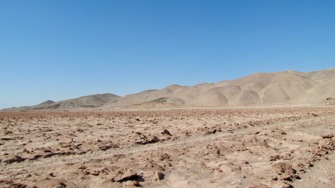
At some point we went through the world’s driest desert, where it may not have rained for 200 years. It looks something like this:
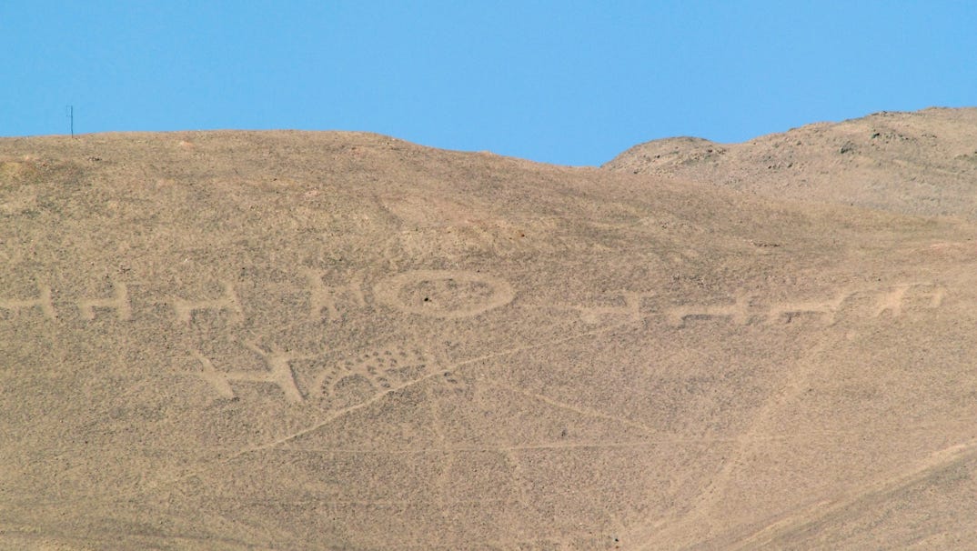
In this area we saw “geoglifos” which are petroglyphs, but on earth, not rock. These could be 1,500 hundred years old.
Iquique is a city of more than 200,000, with reportedly the finest beaches in the nation. To get down to it (about 1,000 feet) the road angles down the enormous sand hills in the area.
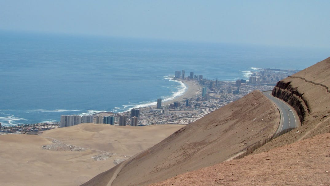
Just after getting out of the car at the beach, the police came by and reported that there was a tsunami alert. So we packed everything back up and drove back up the long climb to the top of the hill, where the photograph was taken. Lots of people were looking for the big wave (that never came). Some people stayed down by the beach.
After a couple of hours, we returned down to the city and I looked up the US tsunami alert page and found out that the earthquake was about 1,100 miles to the south, and that it would not produce a tsunami. This was the day the new president was sworn in, so perhaps the Chilean navy was taking no chances.
Iquique has a lot of newer residential buildings, but a lot of very small houses, too. It practically never rains here, so roofs in places are made only to keep out the sun.
We set off from Calama for the drive to Iquique, the starting point for a trip up toward Bolivia.
Next—we will go up the highway, from the ocean to the border, to see the Isluga National Park.