
Iquique to Isluga
Friday, 12 March 2010
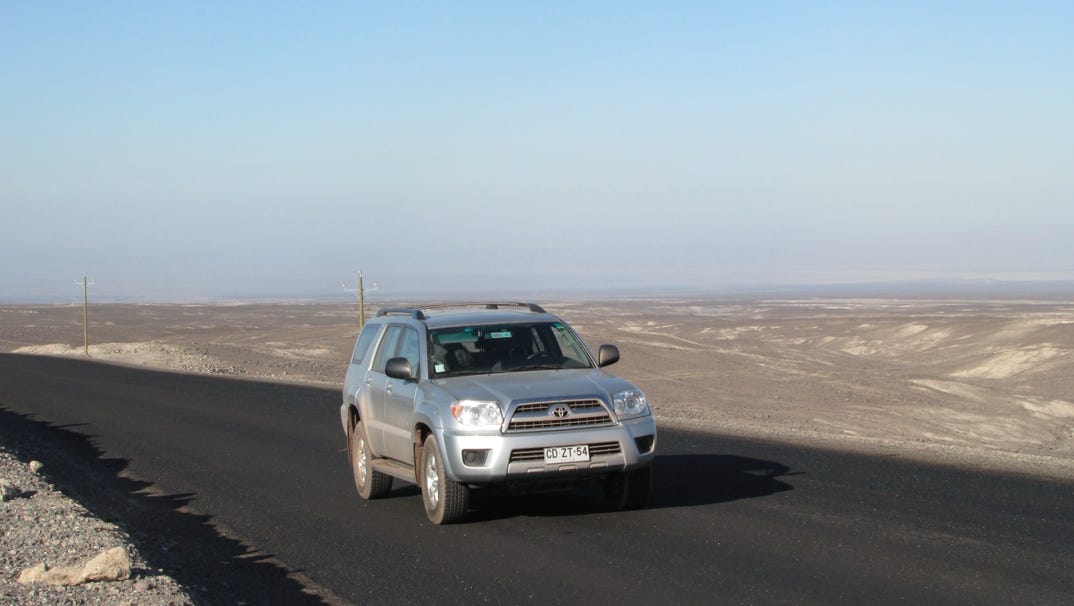
Waiting out the tsumani, we filled the gasoline tank. It was about 40 miles back up and out to highway 5, and then north a bit to Huara, where we would turn off for Isluga. And get gas.
When we got to Huara, though, there was no gasoline.
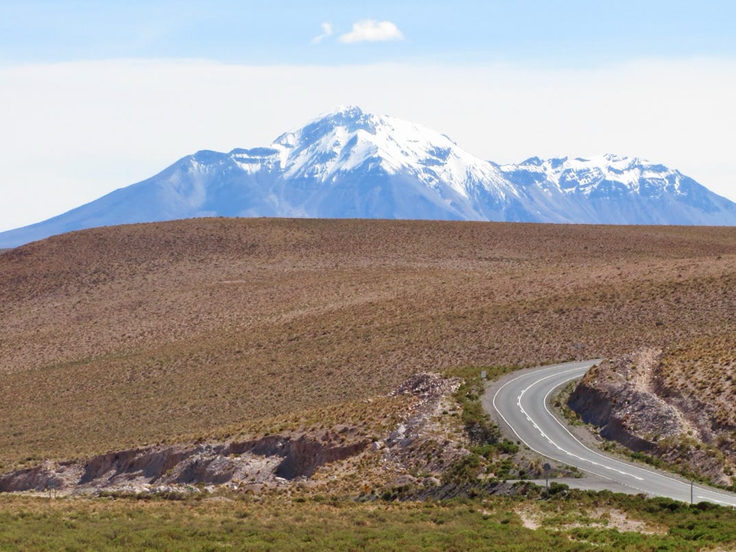
From Huara, we climbed up into the mountains on the paved highway. Much of the early scenery was just like this:
The above is not the best photo ever taken, because the camera had to be aimed into the sun. Once we reached the mountains, we entered an area called Quebrada de Ocharaza.
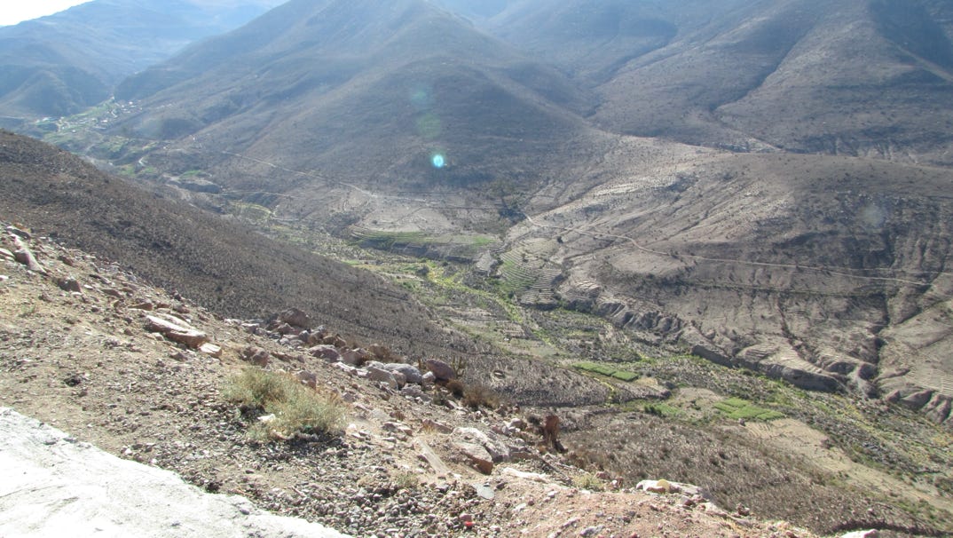
This is Pachica, a village down in the canyon, with terraces and crops. The Quebrada has quite a few of these isolated villages. The mountains generally are just rock, and look like rolling hills, except they might be more than 1,000 feet or more above the river. We are not sure about the elevation, but it looks over 6,000 feet.
We drove up and up, and then we found out the guidebooks that said the road was paved all the way to Bolivia were...incorrect. Still, we didn’t need the big SUV with four wheel drive. For most of the trip, at least.
Eventually, after another couple of hours, went over the pass and started the decent down towards Isluga and the Bolivian border.


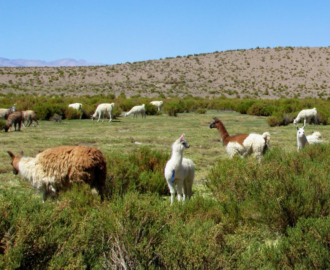
The turn off to the national park was coming up on the left. There was a nice sign about all of the things at Isluga National Park, but essentially there were no services. But there was open space, a lot of water and just us as the visitors.
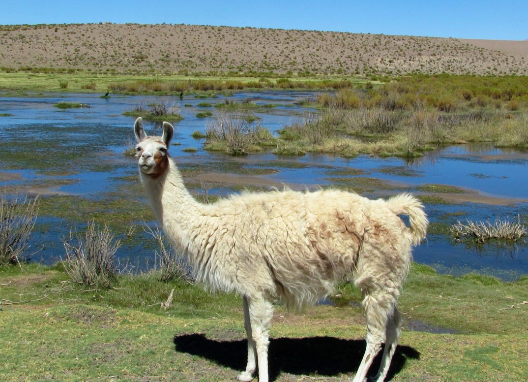
And llamas, lots of them.
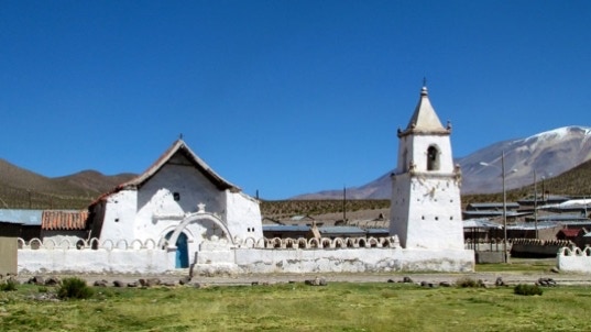
After a wrong turn, we ended up in Isluga, a ceremonial village with a famous church, built sometime during the 1600s. Elevation, about 12,500 feet.
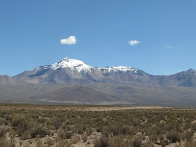
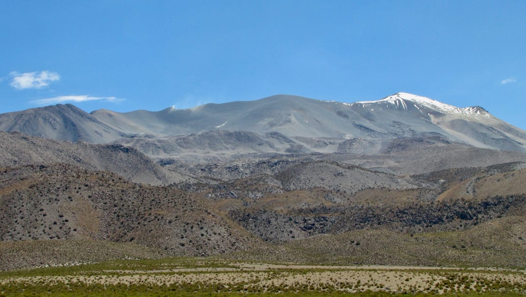
In the background is part of the 18,000 foot high Isluga Volcano.
Here is more of the volcano. If you look at its top, just left of center, you can see steam coming out of the crater.

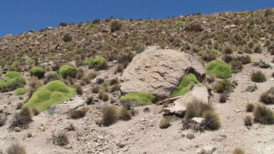
I like these odd looking green throw rugs, which were common above 10,000 feet. I do not know the plant’s name, though.*
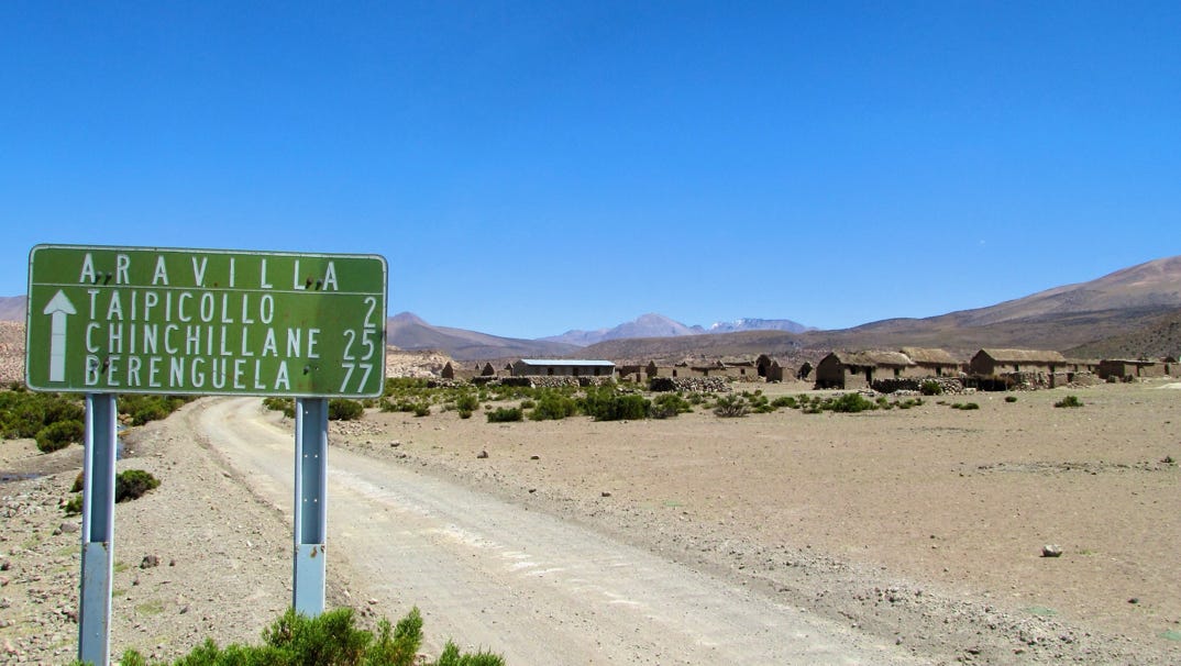
The only time we used the four wheel drive was to go through a stream, and that was to get to this little village of Aravilla. Our trusty map spelled it Arabilla, and the guidebook reported a large lagoon here. Wrong again. Our fuel consumption was about 50 liters/13 US gallons. We are unsure how much we had left in the tank but glad we did not risk going any further.
* update 1 August 2010. The plant is yareta. This is from E. Wasley, who has some great photos of the Atacama and other areas in South America up for viewing.
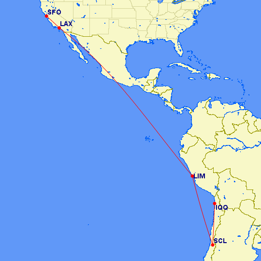
The next day, we turned in the rental car and flew from the Iquique airport back to Santiago where we spent the afternoon and one night just below Cerro San Cristobal. We rode the funicular to the top. We also strolled through a lovely sculpture garden along the Mapocho river.
The next day, we took several flights to cover 6,000 nautical miles getting home, 11,100 kilometers. The airport authorities in Santiago have done a great job with keeping things moving in tents while they repair the earthquake damaged terminal building. We were not originally supposed to stop in Lima, but all flights were changed due to the earthquake, so we were just happy to make it home.
We set off from Iquique to drive to Isluga National Park, near Bolivia.
Next—Santiago and a long flight home.