
North Beach to Union Square
North Beach to Union Square
Saturday, 15 May 2010
It was a typical “summer” day with morning fog that would burn off at some point in the day. We drove to the Fifth and Mission garage and took the 45 trolley back to Washington Square.
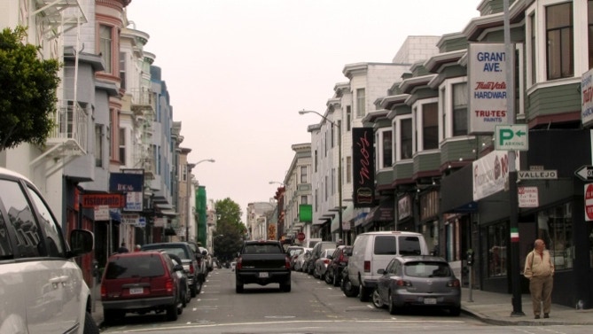
Now that we have a real map of the 49 mile drive, we made a minor course correction and walked along Grant. This photo is typical of the area, dense, two and three storey buildings; residential above the street level.
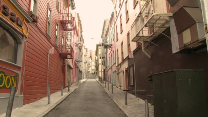
There are also old alleys which don’t see much traffic, but do bring fresh air and light to residents living in the backs of buildings. This is Fresno Street.
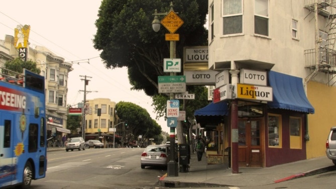
We’ve got it figured out now. The Seagull sign shows we are on the right track, going the wrong way, of course. This is the intersection of Columbus and Grant. That’s Molinari over on the left at Vallejo Street.
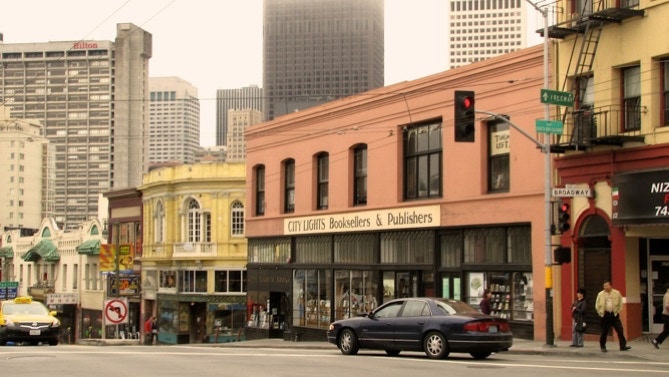
We turned onto Columbus and headed downtown. Here is City Lights, a great book store.
Right around the corner on Broadway is the Beat Museum.

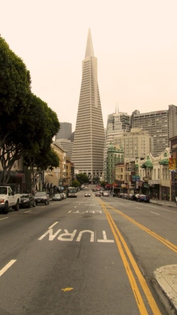
Here is the view in front of City Lights, looking down to the Pyramid. The 8 storey building in front and to the right of it is Francis Ford Coppola’s American Zoetrope movie facility.
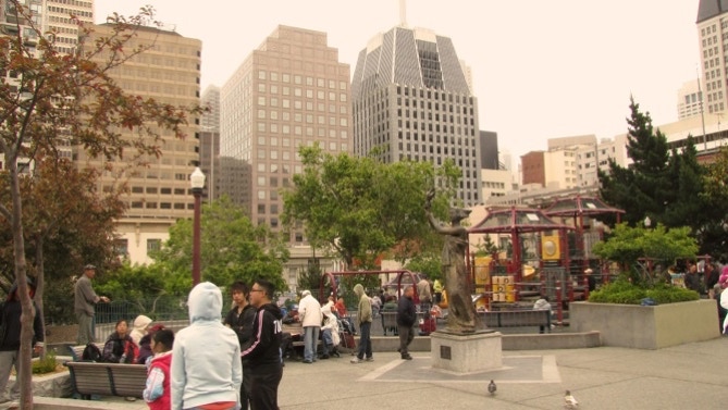
This is Portsmouth Square, which goes back to 1846, when Captain John Montgomery of the USS Portsmouth seized Yerba Buena (the early name for San Francisco).
The statue is the Goddess of Democracy. The square gets a good crowd, even on days when the sun hasn’t burned off the fog.
Here is Waverly Place, running parallel to Grant. Tourists miss this street, and Stockton, as all of the guide books put them on Grant, which is not nearly as nice.
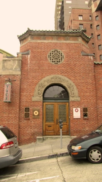
Walking up Clay, we came upon the YWCA, a very attractive building designed by Julia Morgan.
Now it is the headquarters of the Chinese Historical Society of America.
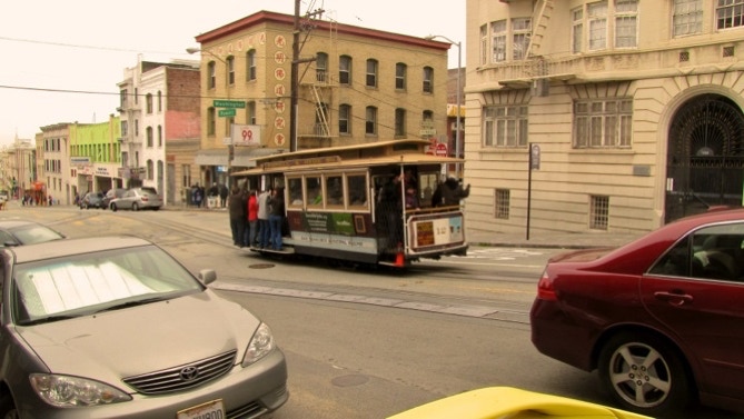
Below shows a short stretch of Powell Street. We are going to follow the cable car line up Washington to the Cable Car Museum.
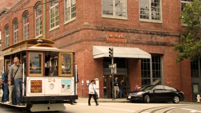
Here we are at the Cable Car Museum. If you click on the link, you can also read about a friend who died earlier this year, Norman Rolfe. He was a big reason freeways do not chop up San Francisco.
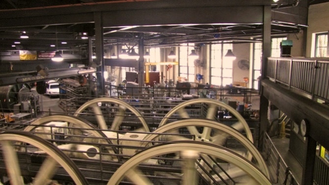
This is not a great picture, because of the light. Inside you can walk right up to the wheels and cables that pull the cable cars along on their routes at 9.55 miles per hour. This large piece of equipment was made in Philadelphia.
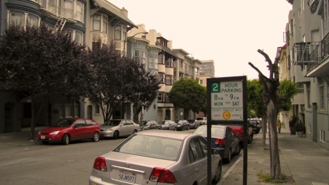
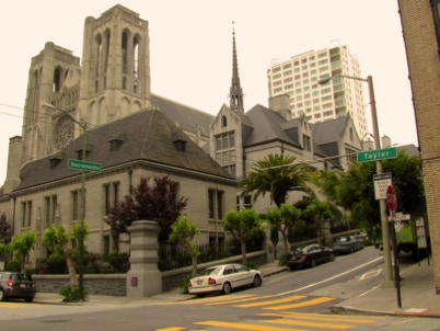
From the “car barn” we turned on Taylor and headed for the top of Nob Hill. This is a typical view in this area, here Taylor near Clay.
Grace Cathedral is one of the imposing structures at the top of the hill.
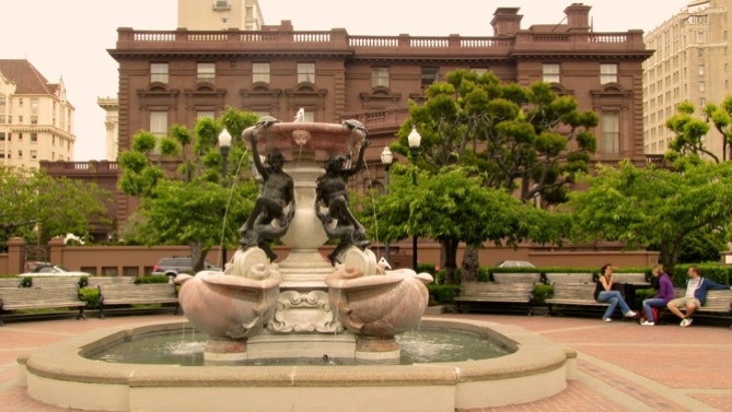
Nob Hill has a big history in the development of California. The Big Four, who ran the Central Pacific Railroad (and therefore, they controlled California) out to Utah, lived up here. Their names live on as Stanford University, the Mark Hopkins Hotel and the now–defunct Crocker Bank. Collis Huntington also built the Chesapeake and Ohio Railway, with its yard at Hampton Roads, Virginia. These people—a guess—were about as rich as anyone in their time.
There is also Huntington Park with its sort of famous fountain. The red house to the rear is the Pacific–Union Club. Before that, it was the home of one of the Comstock Lode silver barons, James Flood.
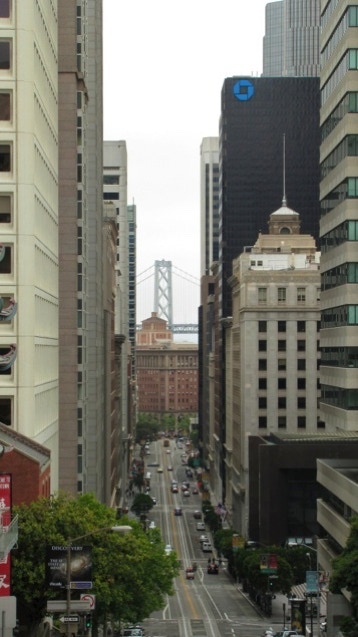
The route next took us down California Street, back to Grant. Here is a view through a part of the Financial District. That’s the Bay Bridge in the background. It’s our route back home.
In front of the Bay Bridge is a large brick building, home of the Southern Pacific Railroad, successor to the Central Pacific.
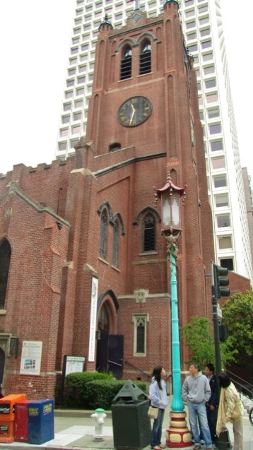
Not much farther down California is Old Saint Mary’s, California’s first cathedral. Most of the building survived the 1906 earthquake. Inside are photos which show all of the destruction.
It’s not an easy building to photograph, as it is tall and hemmed in by other buildings.
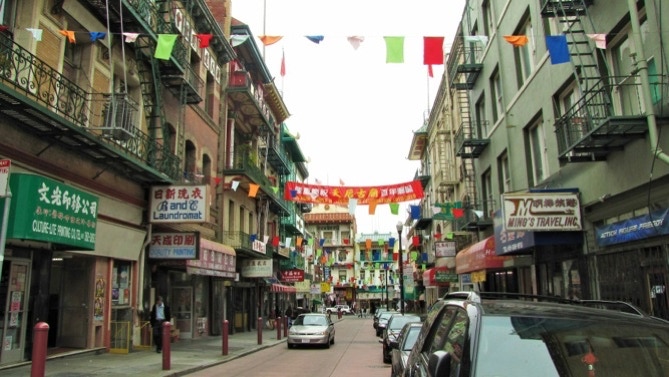
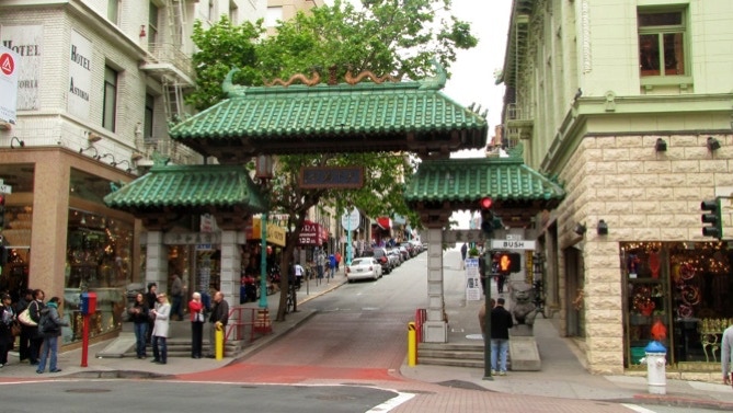
Here is a look north along Grant. The sun is just starting to come out. Nice red lanterns.
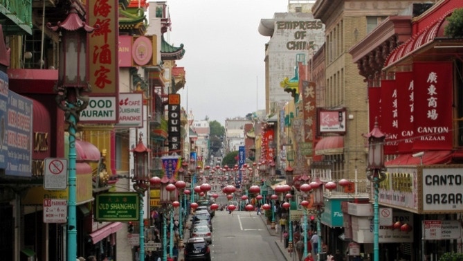
This shot must have been taken by every tourist. So why not, here’s my version of the “entrance to Chinatown.”
We walked down Grant to Post, and turned right towards the ocean.
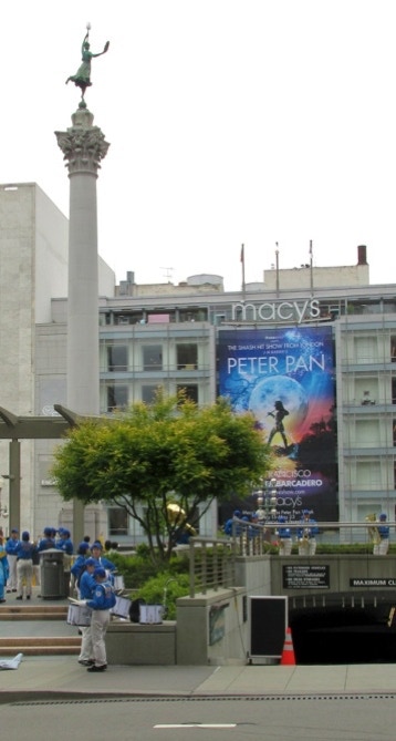
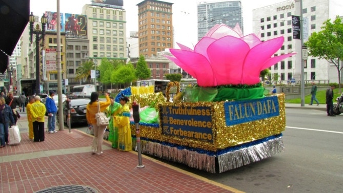
This is a partial view of busy Union Square.
Today there is some sort of Falun Dafa event going on.
The column and statue are to “celebrate” Dewey’s victory over the Spanish in Manila Bay. His fleet sailed from San Francisco. The statue is a model of a real person, Alma de Bretteville Spreckels. Make sure you click the link and read about her.
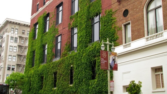
Continuing up Post, we came to the Olympic Club’s downtown building. The club also owns several golf courses out by the beginning of our walk, near the San Francisco Zoo. It is the oldest athetic club in the country, founded in 1860.
I once worked with someone who was a member, and I think the swimming pool inside is salt water. They have a pipe that goes out about 5 miles to the Pacific Ocean.
After stopping at Leavenworth Street, we walked back down Sutter to lunch in Claude Lane. Of course, while we were eating, the sun came out.
Our walk today was 2.5 miles in length; we’ve covered about 17 miles so far.
We begin today at Washington Square and walk through part of Chinatown, then up to Nob Hill and then back down to Union Square. From there we walked west on Post up to Leavenworth.
Next—out Post to Japan Center, then turn around and walk back to City Hall and then on to the Transbay Transit Terminal.
