
Ayers Rock & the Red Center
Monday–Thursday October 31 to November 3, 2011
We flew 1,354 miles to Ayers Rock and the the large desert known as the Red Centre. A Qantas strike almost derailed our trip, but we were able to find a flight on Virgin Australia at the last minute. Phew. We picked up a rental car and drove 3 hours on our first segment out to Kings Canyon in Watarrka National Park.


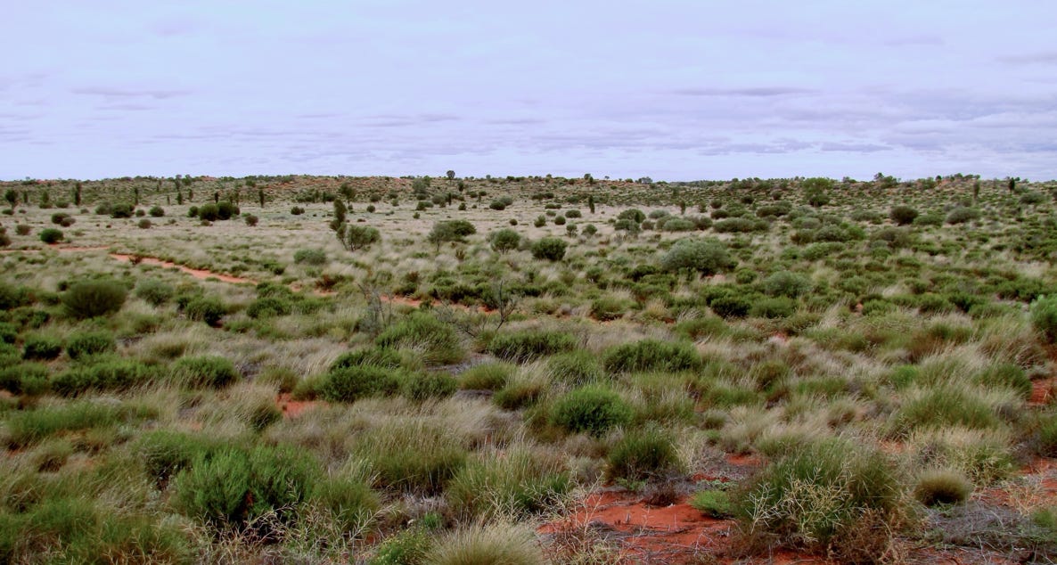
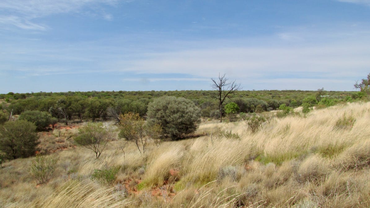
We rented a car at the Yulara airport (aka Ayers Rock), and set out for the three hour drive north to Kings Canyon in Watarrka National Park. It was a cloudy day, but very soon it became clear that the desert has a lot of plants.
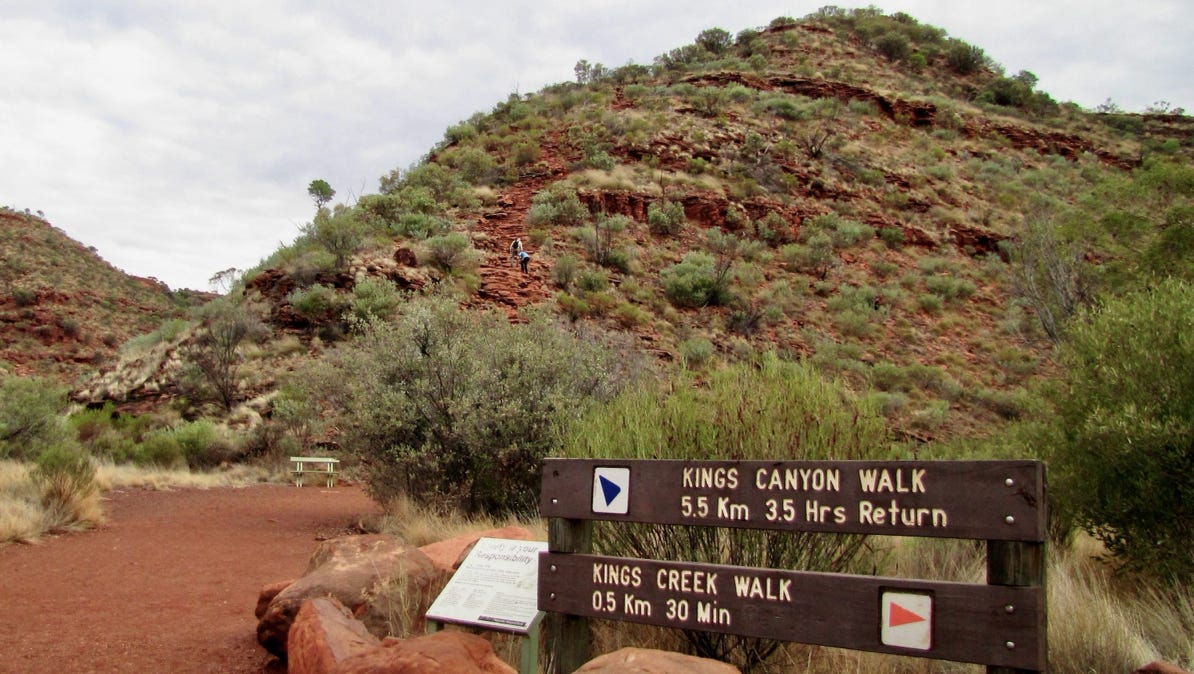
It was cloudy, again, when we started out for the canyon the next morning. There are two trails in the canyon, and having seen the rocky condition and drop off on the higher one, we opted for the lower trail.

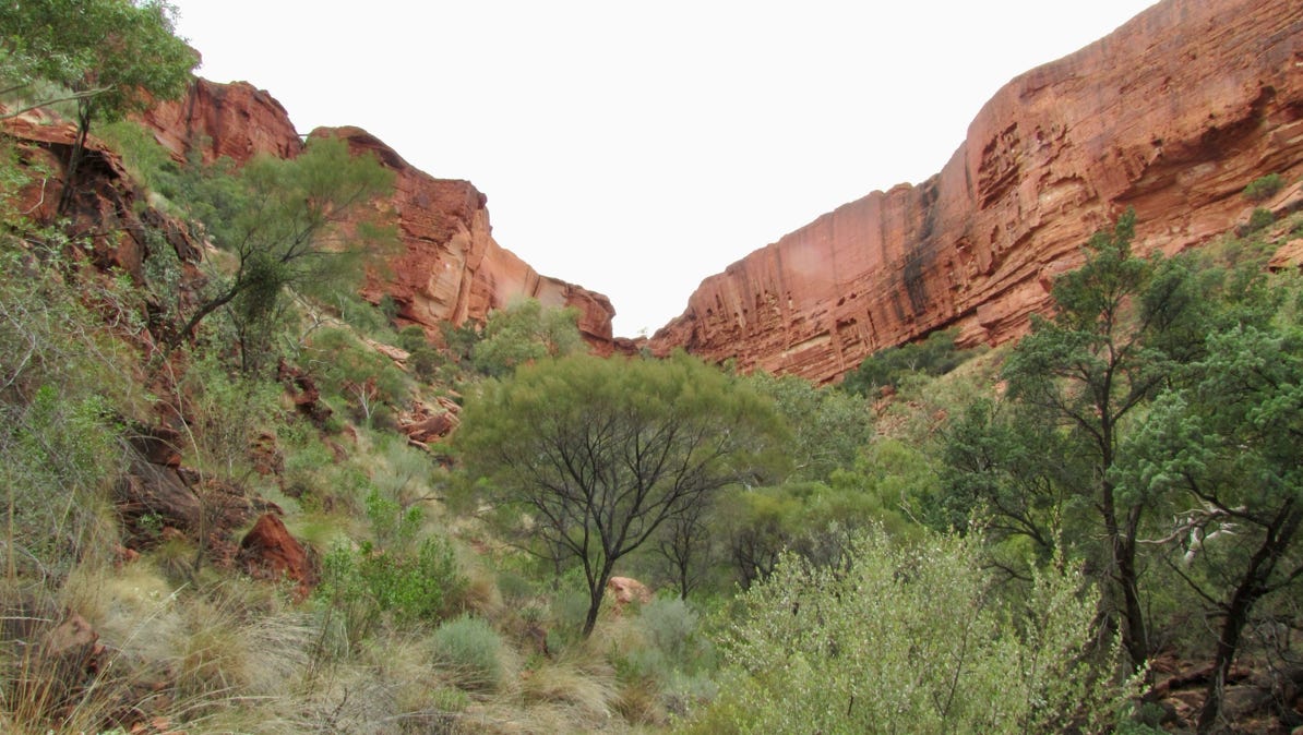
As we got to the canyon, the clouds began to lift. The walk ended here, with a look out up to the dead end of the canyon. The walls here are quite high. The other trail runs along the top, and we saw a few people up on it.
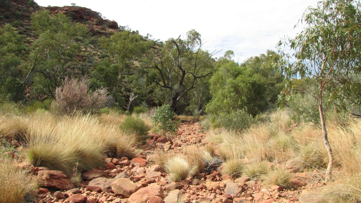
When the sun came out, the views got better. Here is a dry creek bed near the mouth of the canyon.

Back at the lodge where we were staying, the sun was fully out. Plants as far as the eye can see in this desert, plus more evidence that the area is indeed the “Red Center” of the country.


After the walk, we drove back to Yulara.
Not far from Yulara is the resort area of Ayers Rock.
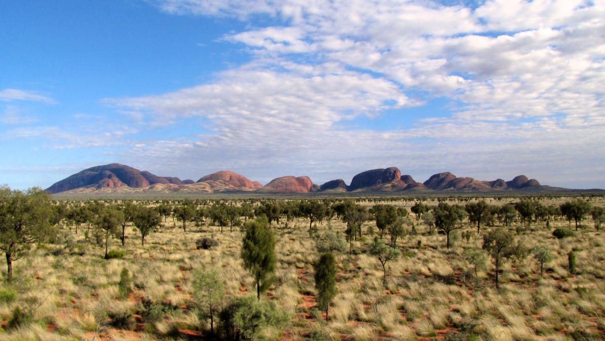
A bit farther out is another rocky formation, and we are going there, too. The combination was called Ayers Rock–Mount Olga National Park until1993, when the name was changed to the more appropriate Uluru–Kata Tjuta National Park. There is a short video of the area linked to the UNESCO web site.
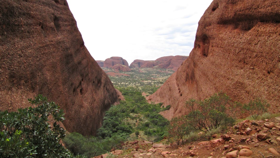
Kata Tjuta, “many heads,” has several trails through it, and we are going to take one of them.
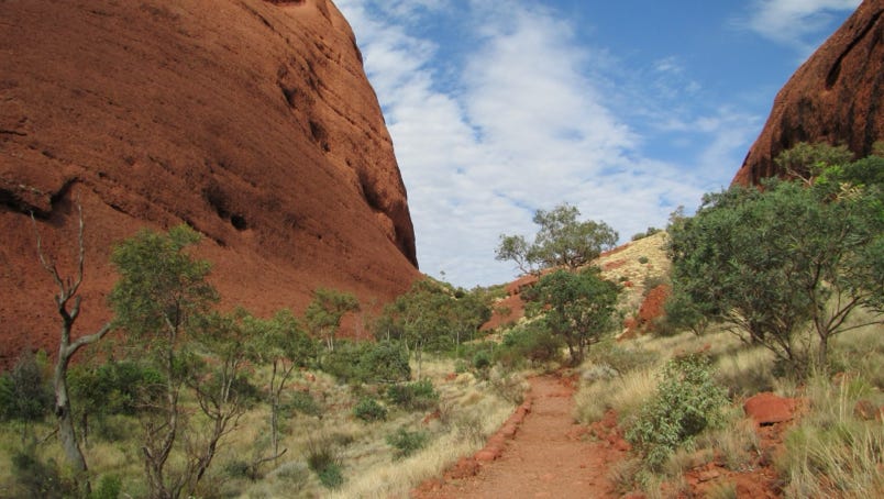
The walk along the Valley of the Winds trail was beautiful, with lots of red rock and running water.

This photo shows the view when we reached the end of our Valley of the Winds walk.
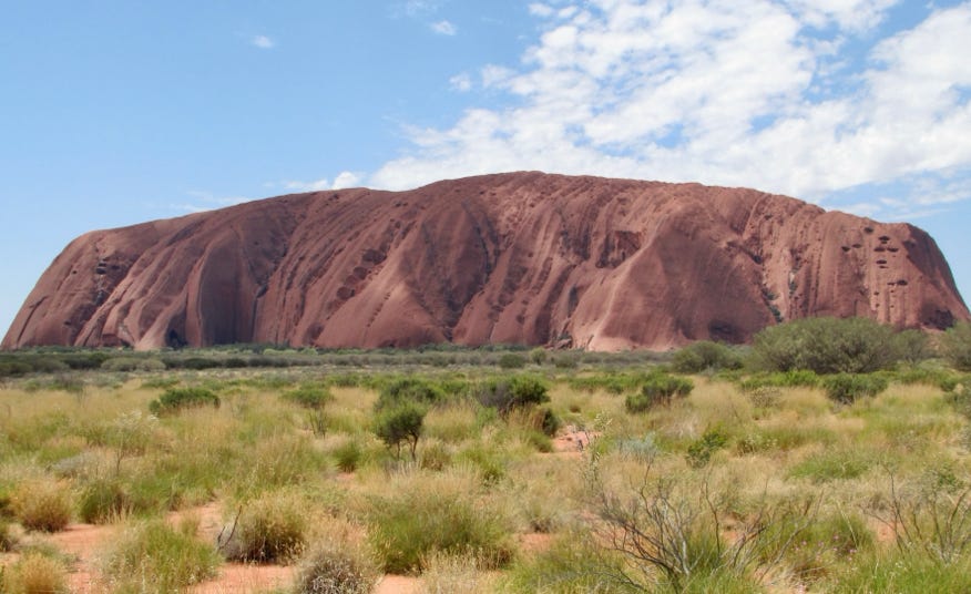
The next day, we went out to Uluru, and walked around it on several trails. There is a “path” up to the top of the rock, but Tjukurpa (traditional law) encourages visitors to not climb on Uluru. We saw a few people giving it a try, despite signs asking that visitors not make the climb. It looked dangerous as well.
The view of Uluru from the airplane was spectacular.
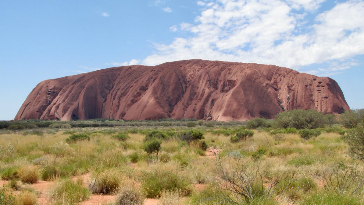
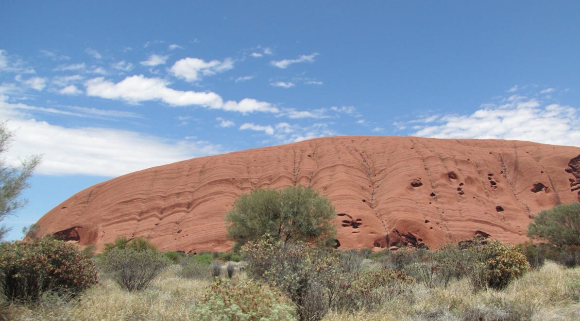
It is definitely red in tone, and as you can see, the walls are very steep. Both Kings Canyon and Kata Tjuta had the same steep and high rock walls.

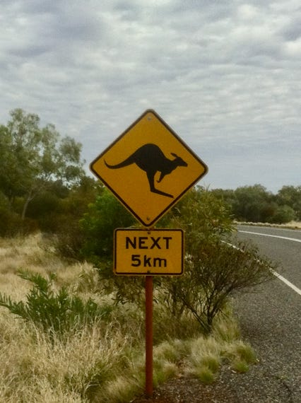
We hadn’t seen any kangaroos out on the highway, yet. But the signs were encouraging.
Tomorrow, we’re going to Perth, on the Indian Ocean, in Western Australia.
Here is a map.
Next—Perth in Western Australia.