Quebrada de Humahuaca
Friday–Saturday November 9–10, 2007
We spent the morning driving 175 miles north, back to the City of Salta (population 460,000) and then continued on the toll road toward the City of Jujuy (population 230,000). Both Salta and Jujuy are the capital cities of their respective provinces. The Quebrada de Humahuaca is a UNESCO World Heritage site. It contains breathtaking mountain and canyon scenery, and towns and villages that date back to pre–Columbian times.
North of Jujuy things change dramatically, with the agricultural belt giving way to the Quebrada de Humahuaca World Heritage gorge extending north towards Bolivia.
Don’t forget to check out the satellite view on the map.

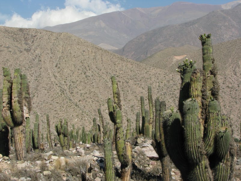
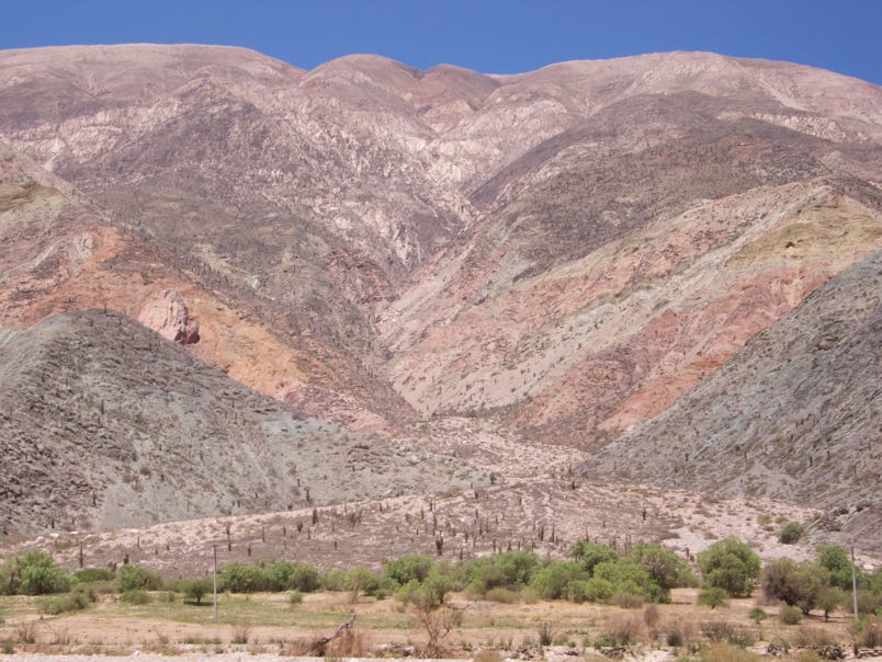
The gorge is about 6 miles wide, and climbs from 4,000 feet to 8,000 feet in what seems like just a few miles. The mountains on either side of the gorge are over 12,000 feet high.
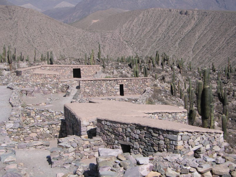
Indians have lived in this canyon for thousands of years, and it was once governed by the Incas. This is the Pucara (fort) at Tilcara. It held out against the Spanish until about 1690.


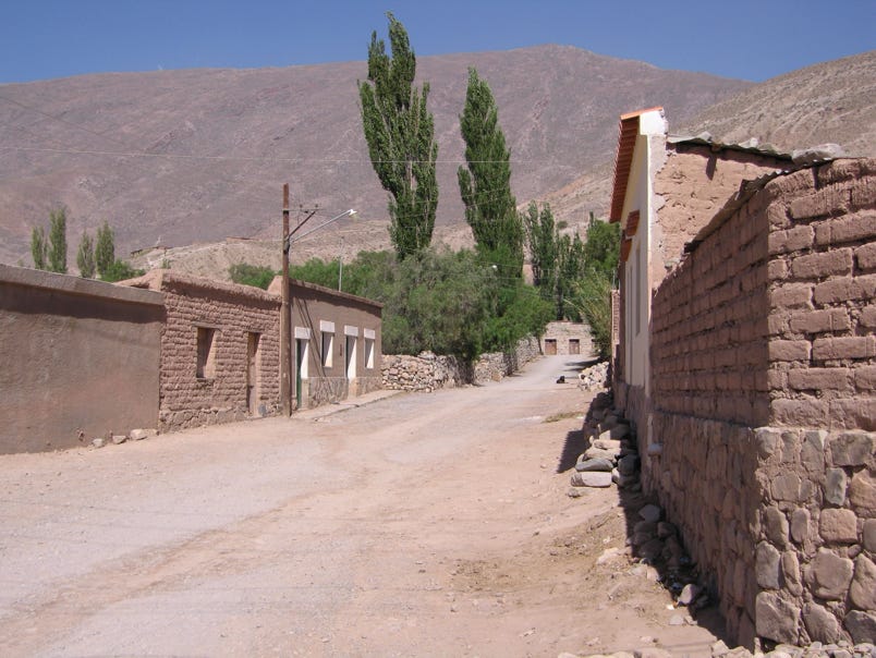
Tilcara is a principal town of the Quebrada. It is at 8,000 feet and has a population of about 10,000. This photo shows a typical street scene. It was 85 degrees and the humidity was 6% when the photo was taken. The sky color in the Andes is remarkable.
Tilcara has a good archeology museum that displays tools and pottery from about 10,000 BC up to the time the Indians gave up to the Spanish. The next day we continued north on the paved highway towards the town of Abra Pampa.
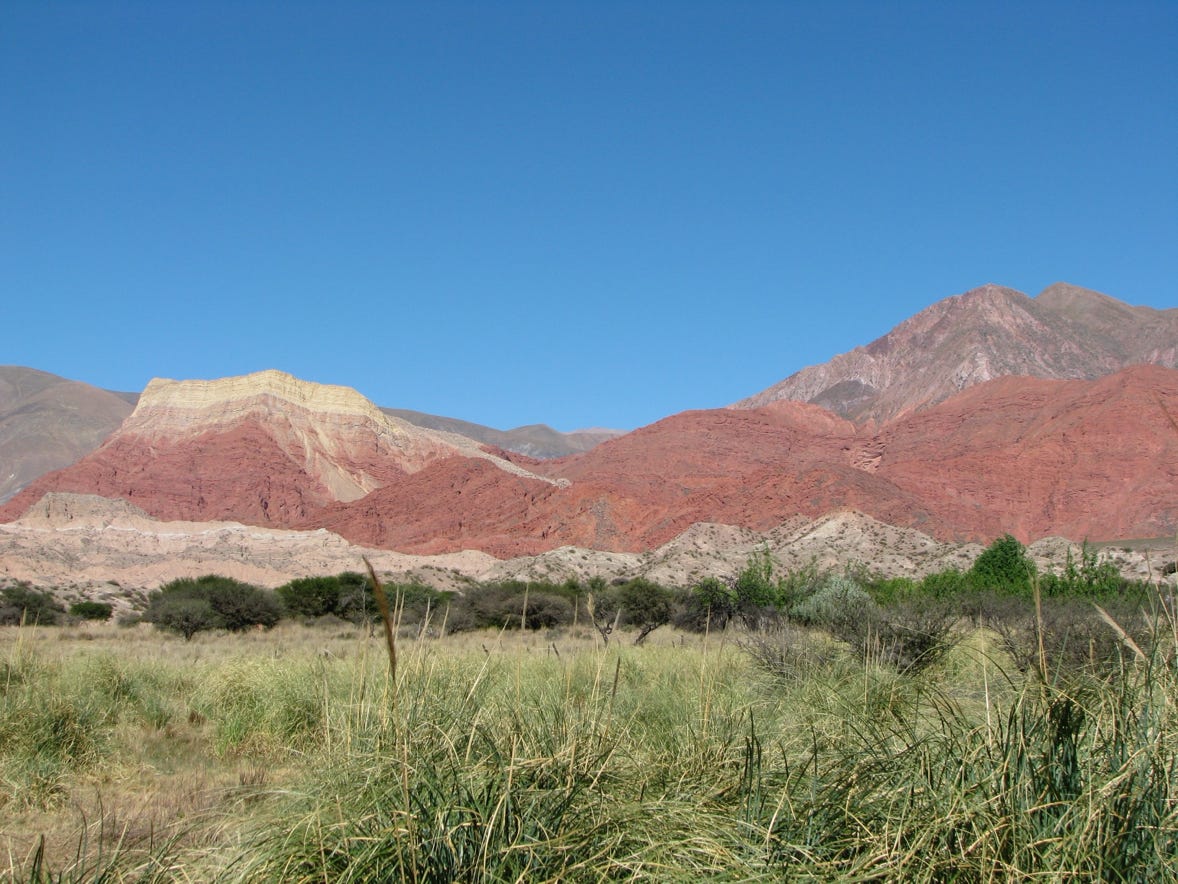
More beautiful colors in the mountains and sky are in this photograph.


This is the Inglesia de San Francisco de Paula, 9200 feet above sea level. It was built about 1692. Inside are wonderful paintings made by Indians under Spanish supervision. Unfortunately, it is forbidden to photograph them.
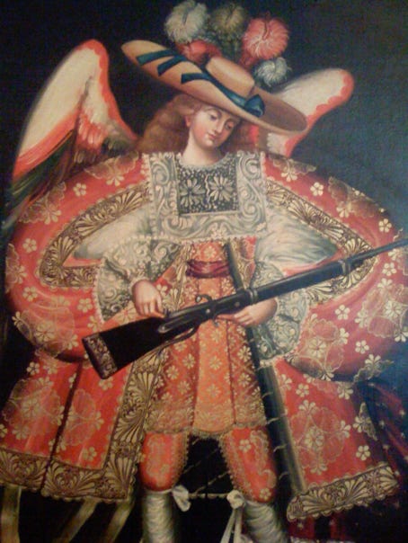
The paintings (“the Angels Squad”) all are of non–Indian angels and all are holding weapons of some sort. This one has a rifle. Note: this is a photograph taken of a reproduction that is hanging in the El Manatial del Silencio in Purmamarca, another town in the area.
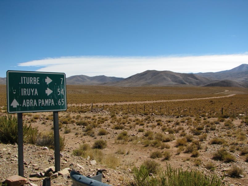
Driving further north, we crossed into the tropics. We wanted to drive on the dirt road to Iruya, but the guide books all say there is a river to ford, and our car was not built for serious water work. The descriptions of roads in this area in all of our guidebooks have significant mistakes in them, and we will never know whether the car would have made it. There was not much traffic to help out in case a rescue was required. We stayed on the paved highway.
At this elevation, about 9,800 feet, we are on the Puna. In Bolivia and Peru the name for this land is Altiplano. Grazing is the principal activity.
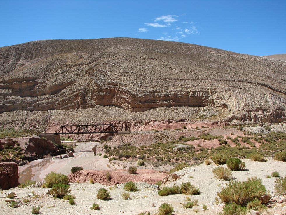
A railway was built from Jujuy, up into the gorge, out onto the Puna, and on into Bolivia. It is no longer maintained, but here you can see one of its many bridges.
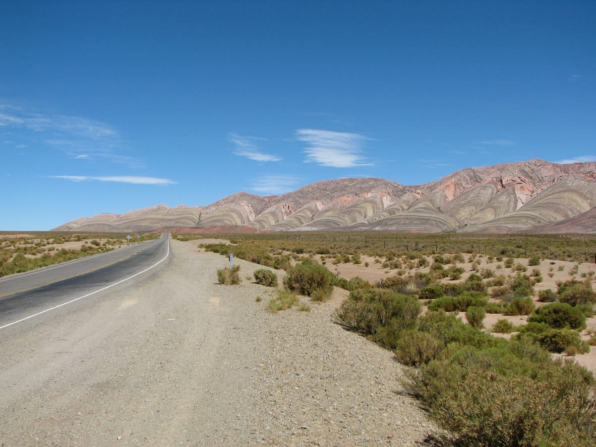
This spot (pink pin on the map) is about where we turned the car around and headed back to Purmamarca, up a different canyon a short distance from Tilcara. This photograph gives a feel for the distances, the different colors of the mountains and sky, and of the emptiness of the road. Bolivia is about 100 miles ahead.


Next—Purmamarca and the Jama Pass road toward Chile.