South to Seward
Monday—Tuesday June 30—July 1, 2014
We left Girdwood early in the morning and drove south towards Seward and tidewater. Seward is the terminal of the Alaska Railroad opened by President Harding in 1923.
Here is a map of our driving route (dark blue), with Byron Glacier shown as the top snow flake pin.

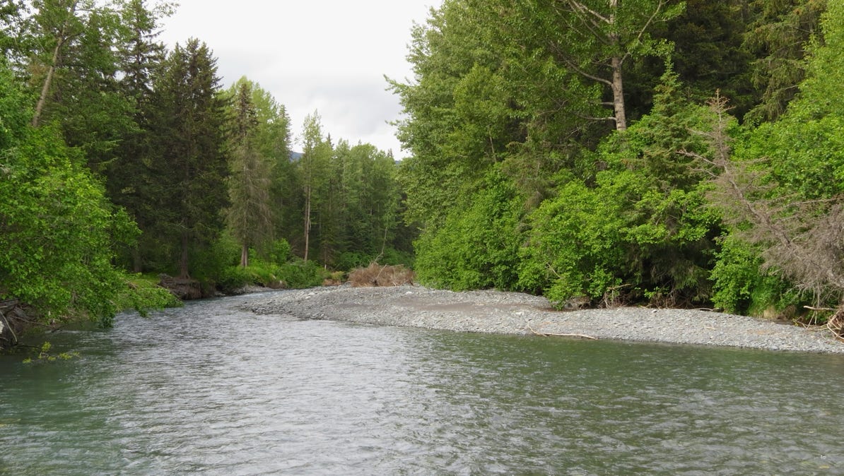
At Primrose Creek, we stopped and stretched our legs with a short hike.
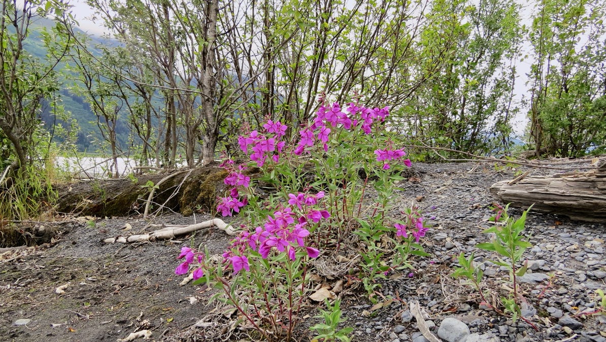
Fireweed is attractive, and it turns out, it is not red!
Our next stop was at Exit Glacier, in Kenai Fjords National Park. It is the only glacier in the park that visitors can reach when driving a car.
Here is the view from a distance.
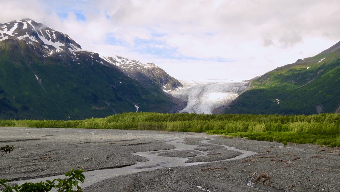
Exit Glacier is a part of the Harding Icefield. The Harding here is the same Harding who drove the golden spike up in Nenana.
Exit Glacier is the snow flake pin on this map. A shift to satellite view will show a view of the fantastic Harding Icefield.
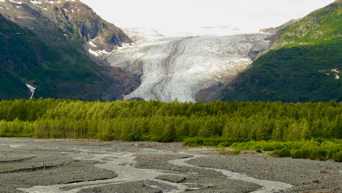
Closer to Exit Glacier.
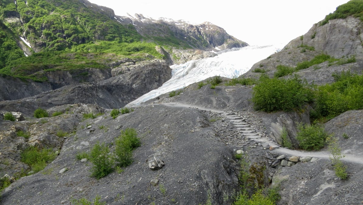
As we drove closer, we saw signs by the road with years on them. The face of the glacier was at a particular sign on the year marked by each sign. In 1998 the face was where the camera is today in 2014. The distance is more than 150 yards/130 meters.
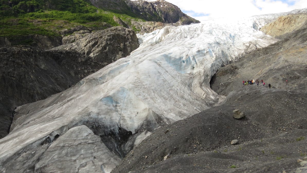
We walked towards the glacier and saw a group of people close to the face. They show the size of the retreating glacier.
We then drove down to the city of Seward and went to the Alaska SeaLife Center. Some of the work of the institution is looking after injured wildlife. In that regard, it is similar to the Alaska Wildlife Conservation Center we visited yesterday. The difference is that here they concentrate on marine life.
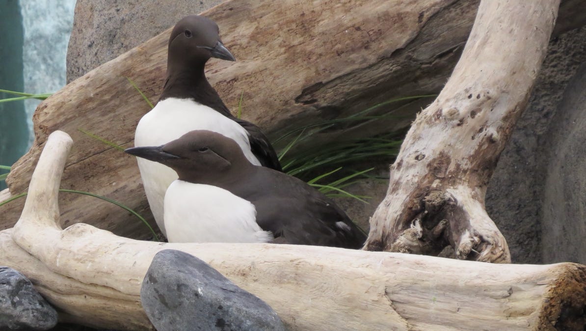
Here are two common mure birds common to the area.
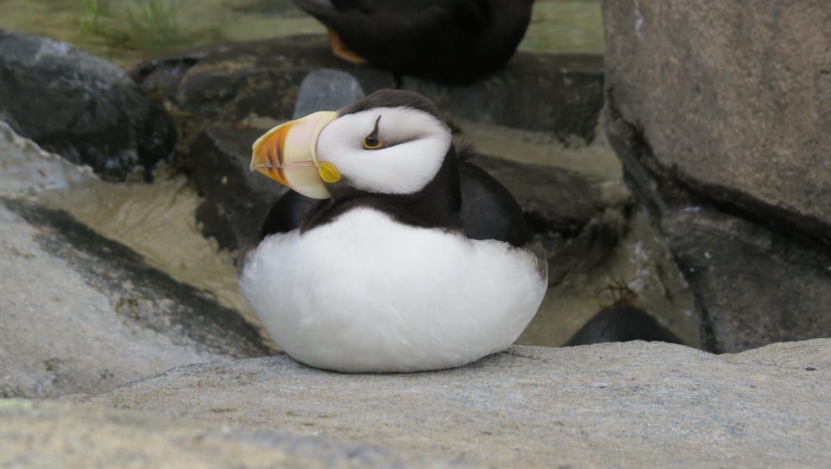
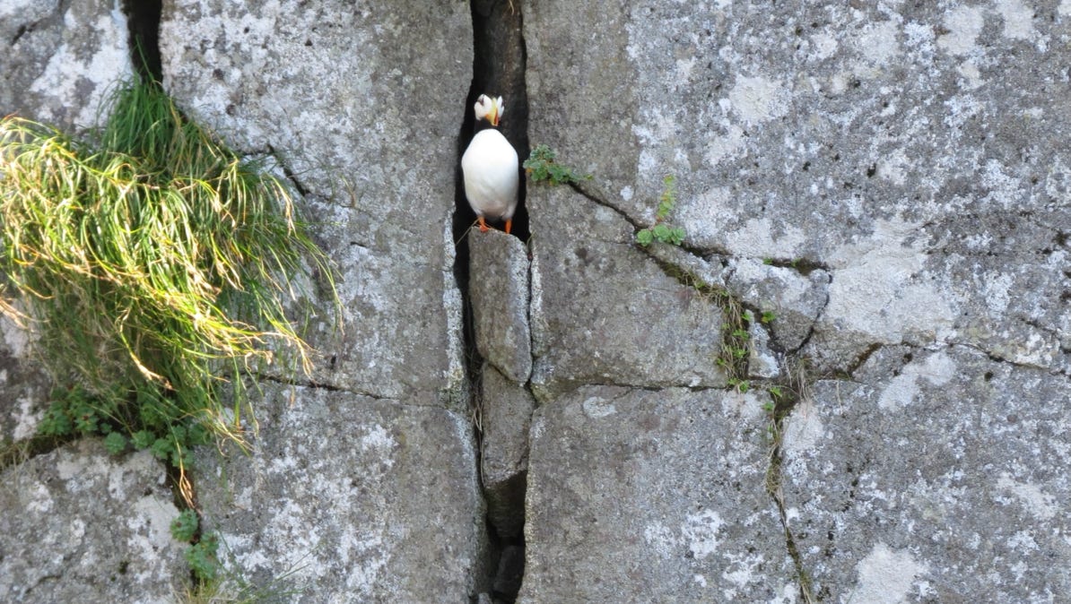
A cute puffin.
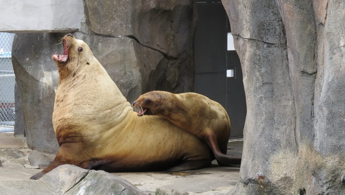
The male sea lion here roared just like a lion in Africa!
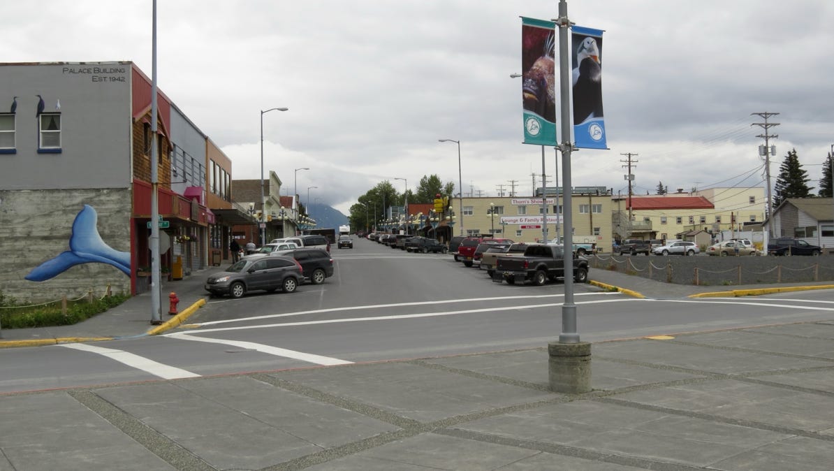
Central Seward from the SeaLife Center.
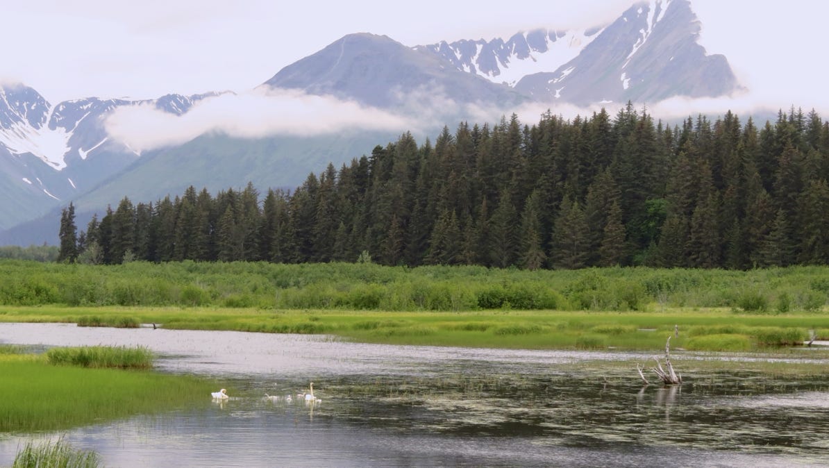
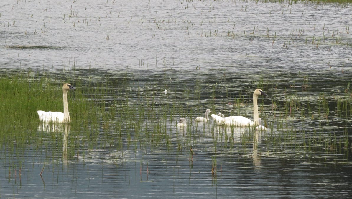
In the early evening, we drove up and around Resurrection Bay to a spot just opposite of Seward and came across a family of swans.
We also saw a large black bear eating by the side of the road, but by the time we got the car turned around, it had moved on into the forest. This is not the first time on this trip we’ve seen a moose or bear by the road and couldn’t slow down to get a great photo.
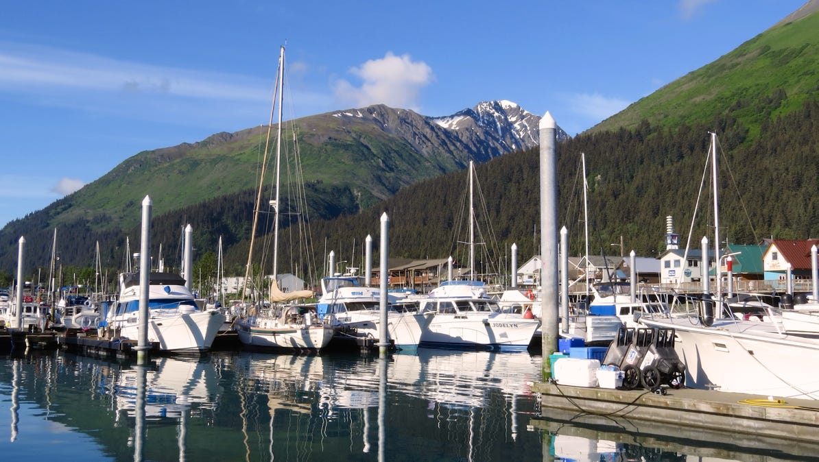
The next morning, we walked over to the harbor to board a boat to take us out for the day to look at the sea side of Kenai Fjords National Park.
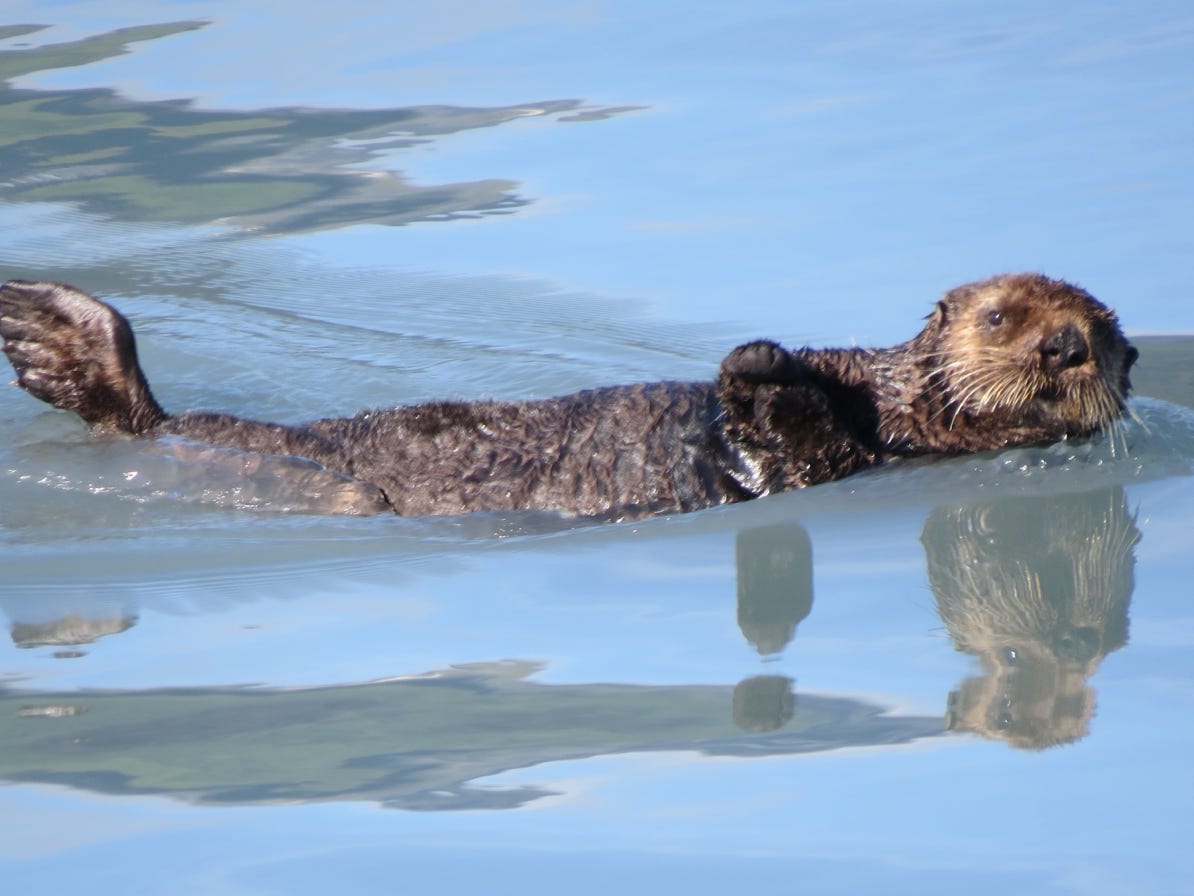
Not long after our boat left the harbor, we came upon a friendly otter.


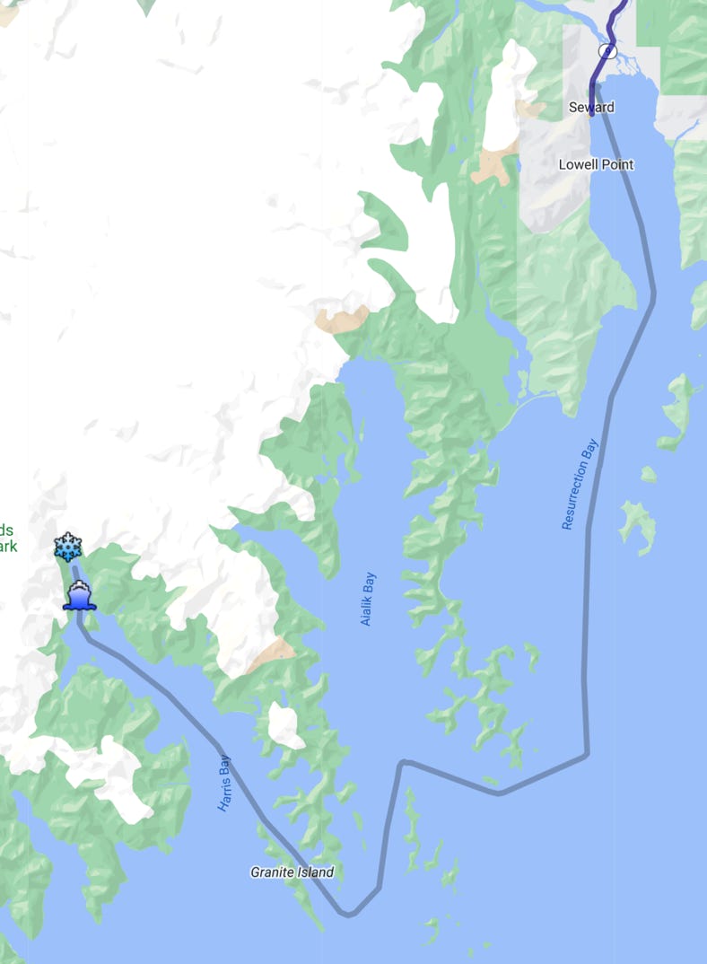
This map shows the boat’s course.
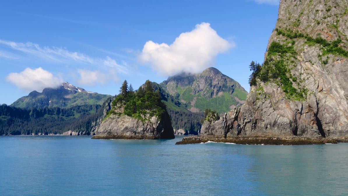
What a beautiful day!
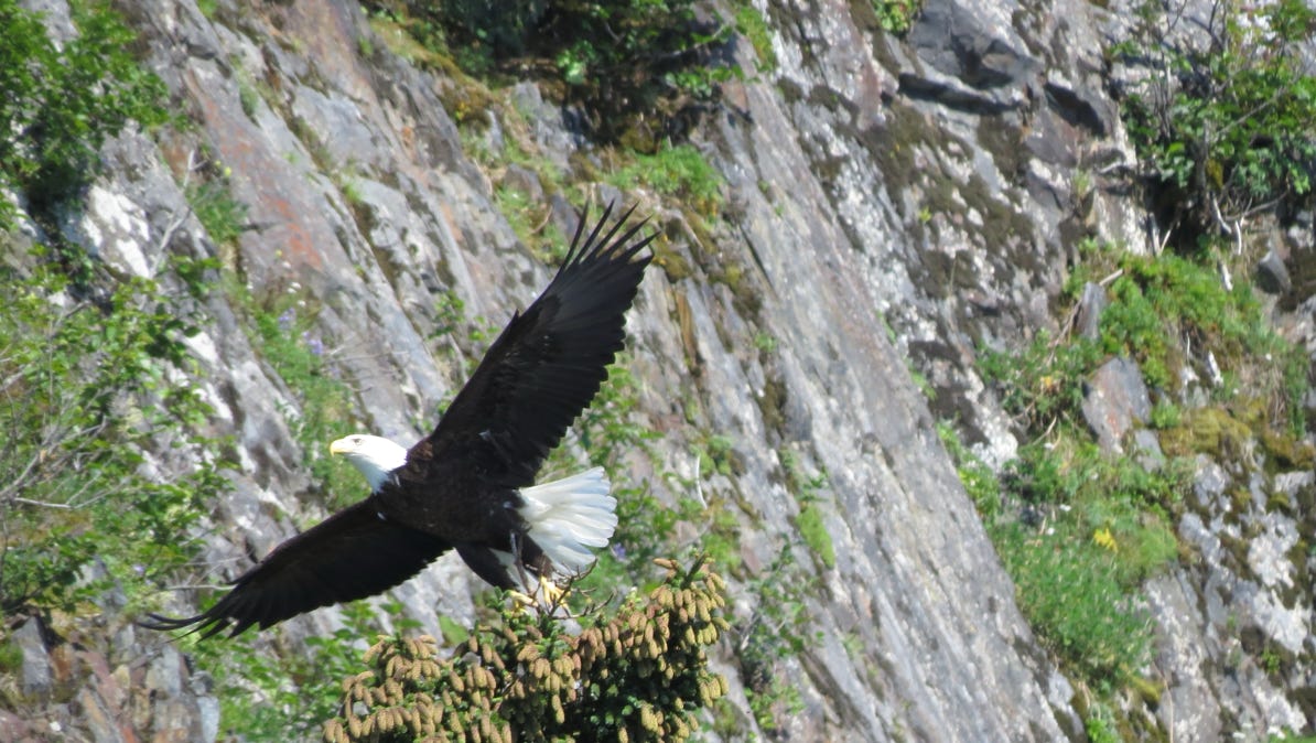
This eagle just took off from the rocks.
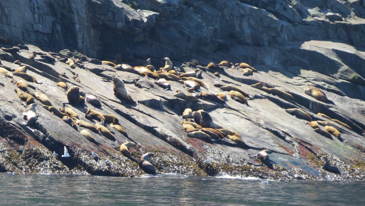
We took many photos of sea lions, but they didn’t turn out as great photographs. Here are a bunch of them, with the babies up high on the rock for protection.
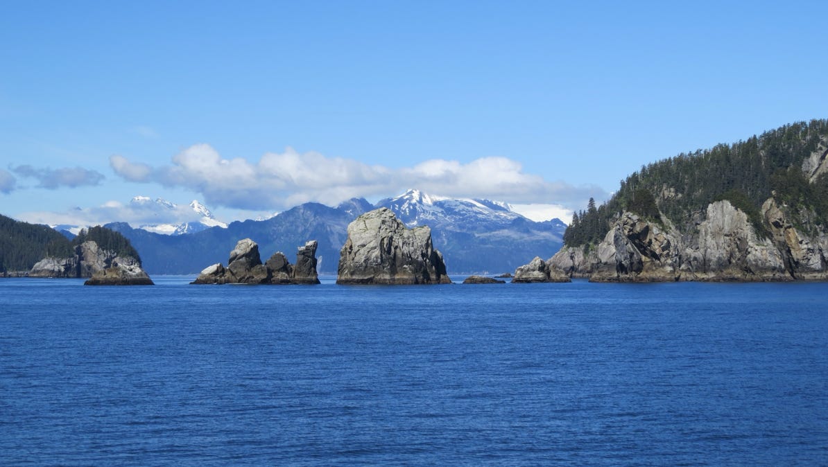
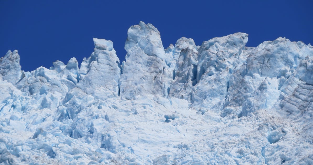
The scenery is remarkable.
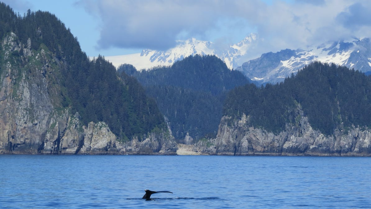
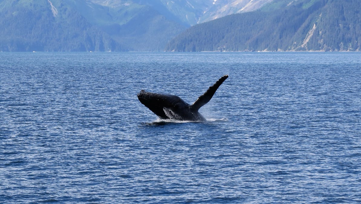
A whale! They are not easy to photograph. We hope we come across another sometime on this trip.
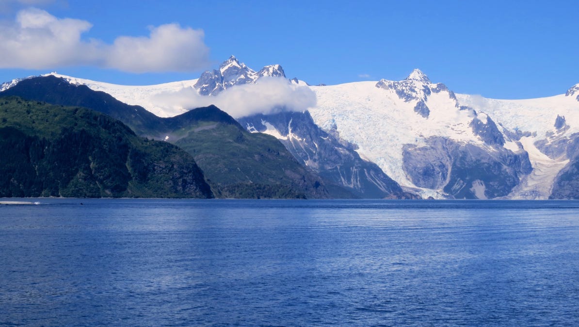
Our boat turned and moved up Harris Bay toward Northwestern Lagoon and several glaciers.
A little island.
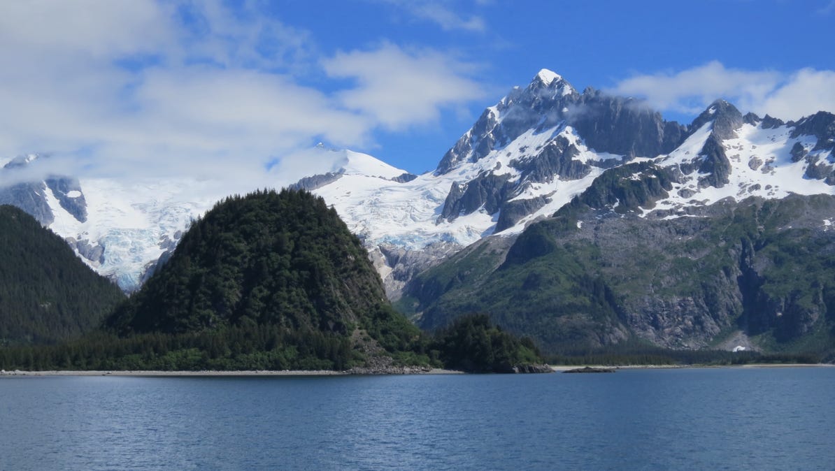
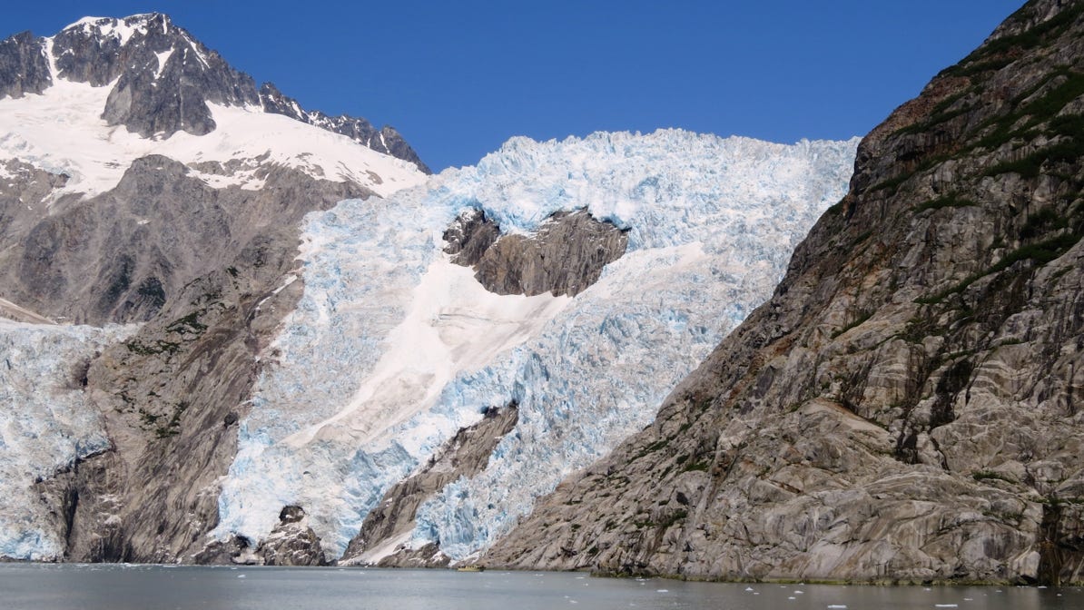
This is a part of the Northwestern Glacier at the upper end of the Northwestern Lagoon. The ice at the top is over 3,000 feet/900 meters above sea level! On the map, look for the snow flake pin on the end of Northwestern Lagoon.
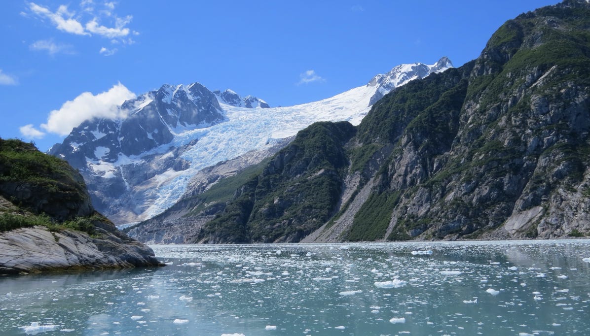
After turning south, we saw ice in the water and another giant glacier.
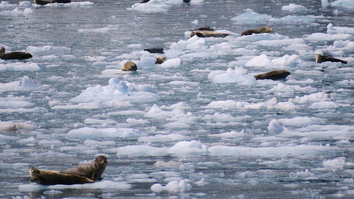
Our boat’s pilot said the seals are out of the water and reclining on the ice to get warmth from the sun.
The boat trip was really worthwhile.
We did see a lot of Fin and Humpback whales on the way back to Seward. One humpback even cooperated with a leap!
Perhaps we will eventually get photos of a bear and a moose!
We drove further south, down to tidewater at Seward. Along the way, we stopped at Exit Glacier in Kenai Fjords National Park. In Seward, we visited the Alaska SeaLife Center and took an all day boat trip to see glaciers and whales in the national park.
Next—Over to the other side of the Kenai Peninsula to Soldotna.

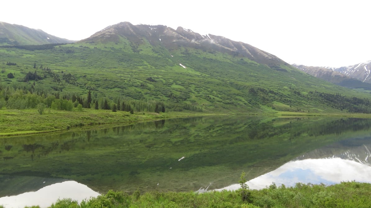
It was overcast, but there was no wind at all. We stopped at Lower Summit Lake and took this photo of still water and the reflection of the mountain.