Two State Big Loop
Friday, 13 September 2013
Last February, US 89 was washed out in northern Arizona, not far from Page. We wanted to go to Lee’s Ferry, 3.25 miles as the crow flies from Horseshoe Bend, but to do required a significant deviation on another highway through the Navajo Nation. On Google’s map, the route is shown as US 89T.

The routing is Big Water to Page, out to US 89T (which was just paved and was known in its earlier version as Indian Highway 20).
Before we got to Lee’s Ferry, we walked across the Navajo Bridge, built in 1929. It ended the need for the ferry.
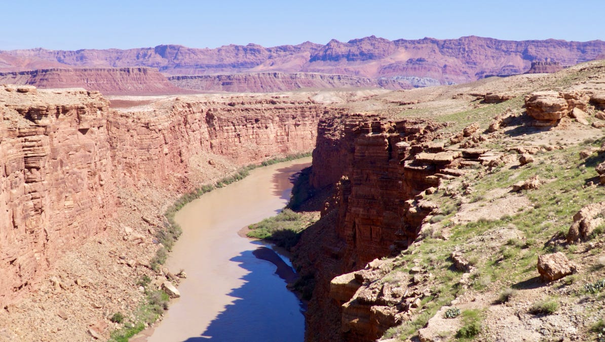
The Colorado River is about 450 feet down from the bridge.
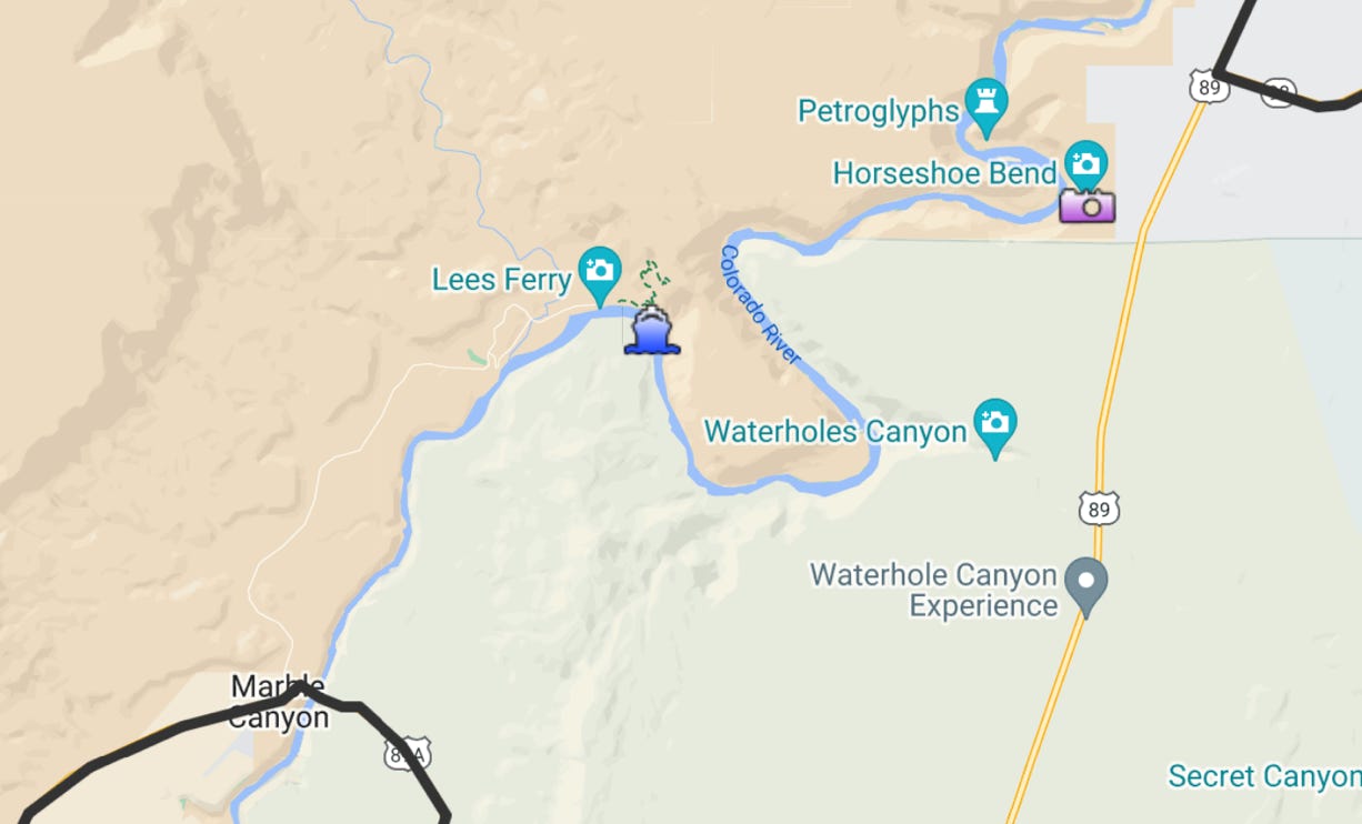
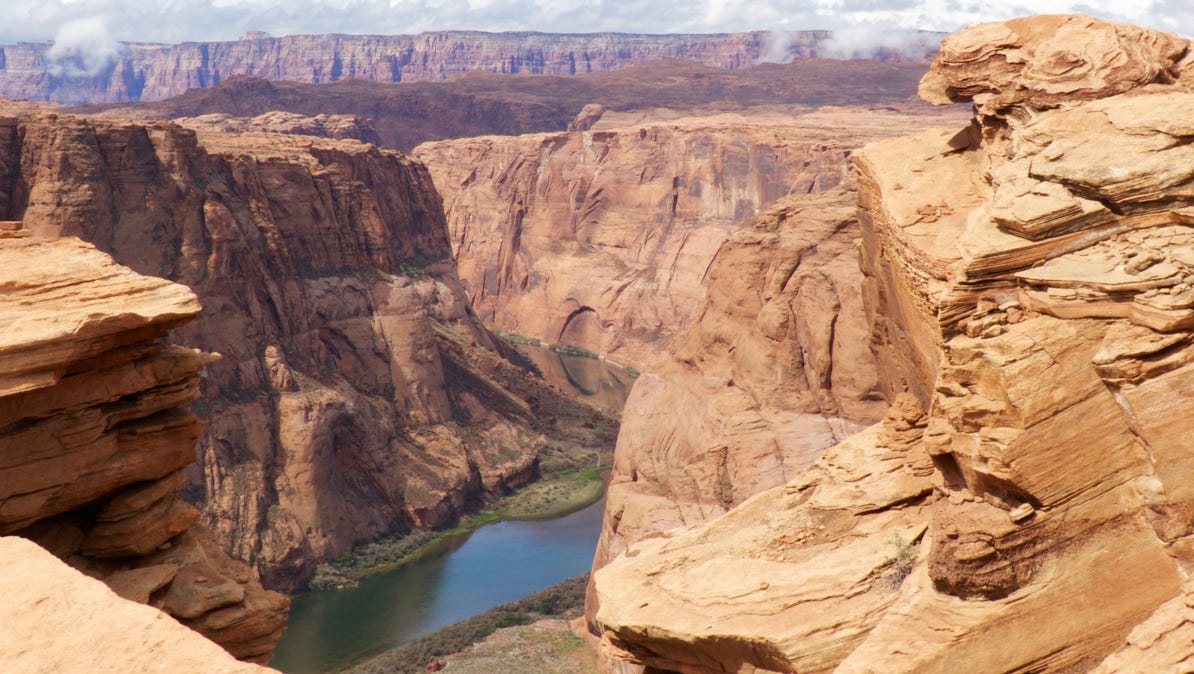
Here’s an enlargement of the map to show Horseshoe Bend (camera pin), Lee’s Ferry (boat pin) and US 89A as it crosses the river at Marble Canyon.
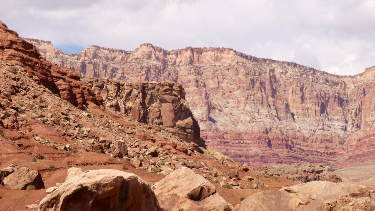
Lee’s Ferry is about 5 miles upriver from the Navajo Bridge. The scenery is impressive!
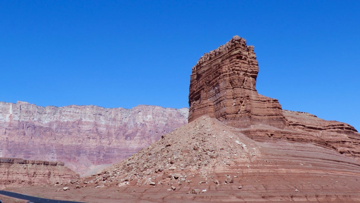
The rock colors are amazing.
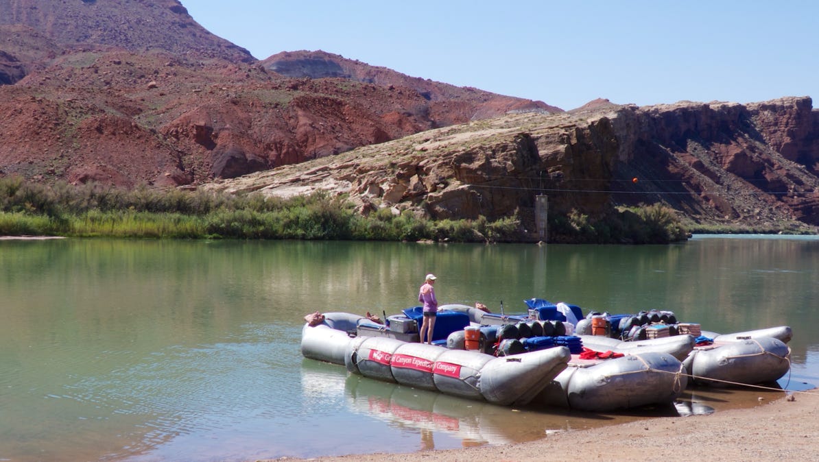
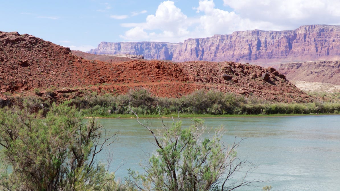
Near the site of the old ferry, rafts put in for the Grand Canyon.
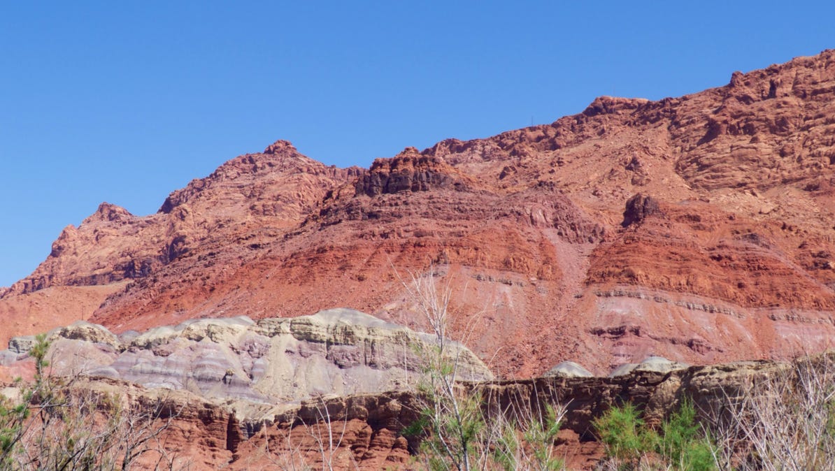
Near the raft launching site, this is the view downriver. The Vermillion Cliffs National Monument is easy to spot.


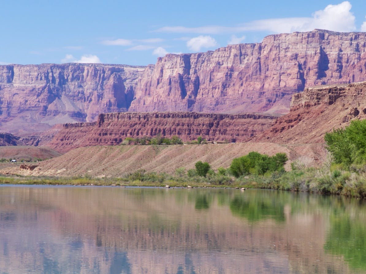

These are the same Vermillion Cliffs, as seen from the Horseshoe.
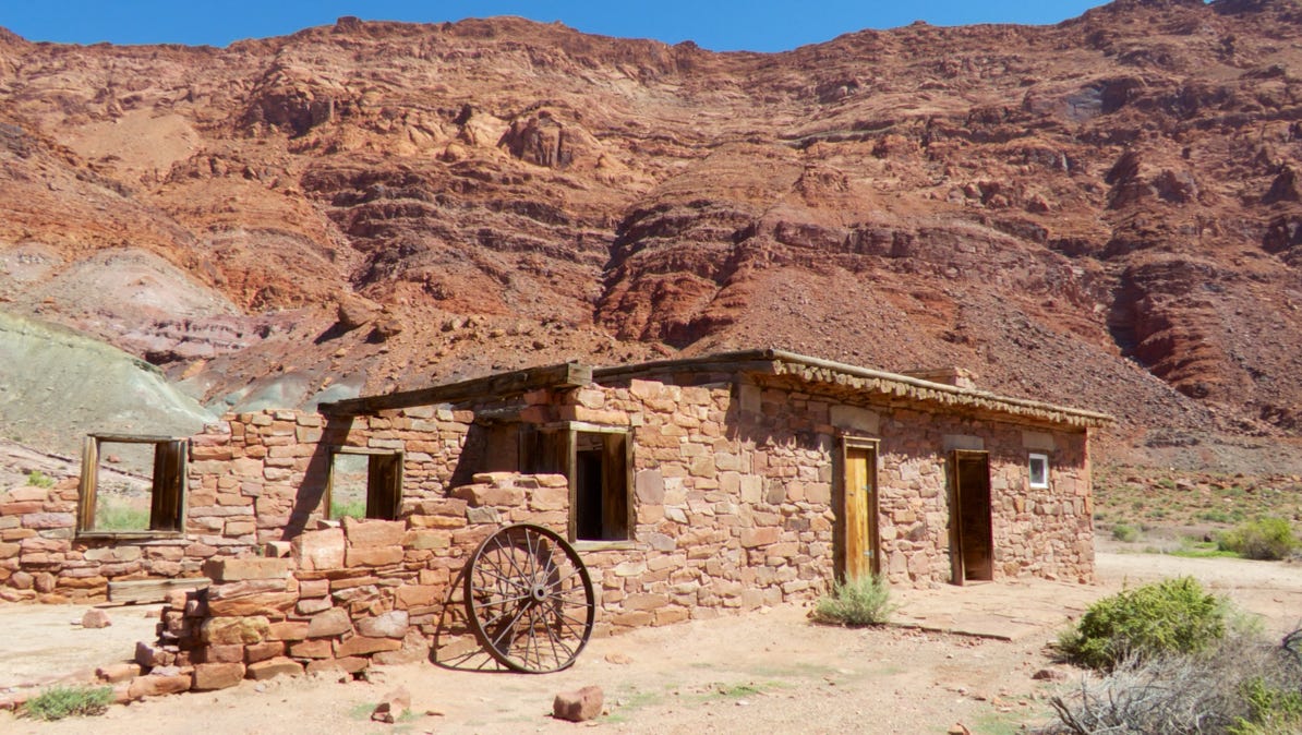
This is the company office of Lee’s Ferry. It was built about 1896.
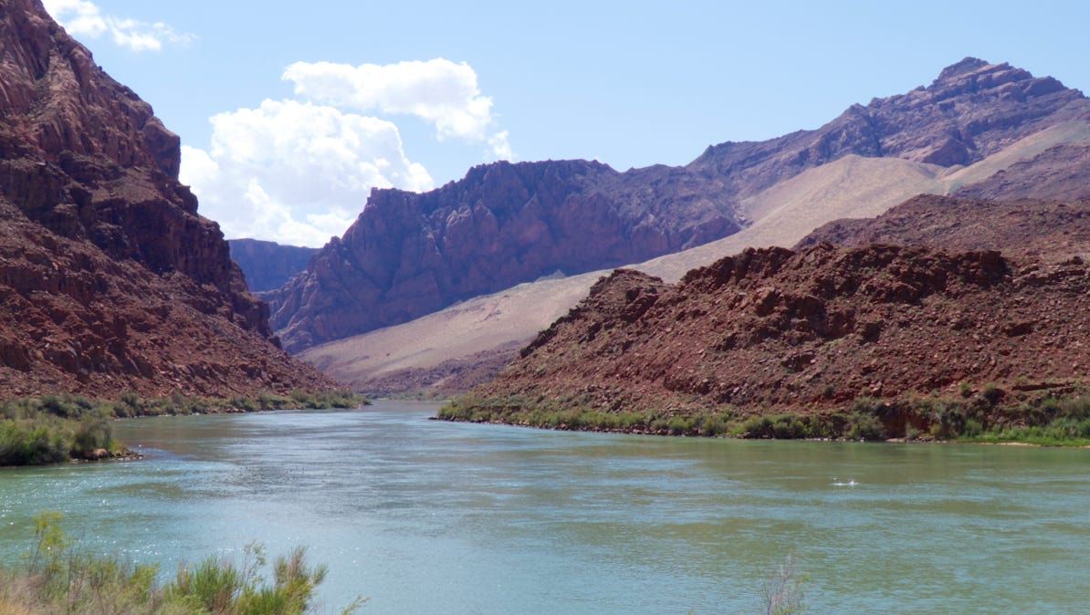
This is the view upriver from Lee’s Ferry. The wagon road on the opposite shore is visible. One sign said Lee’s Ferry was the only vehicle crossing in 800 miles of the river. Another reference reports the gap as 500 miles.
It’s the first time we’ve been at river level, except in California, where there are no mountains to impede travel.
While it isn’t marked, we think this is the site of the ferry. On a nearby sign is a photograph of a Conestoga wagon on the road across the river.

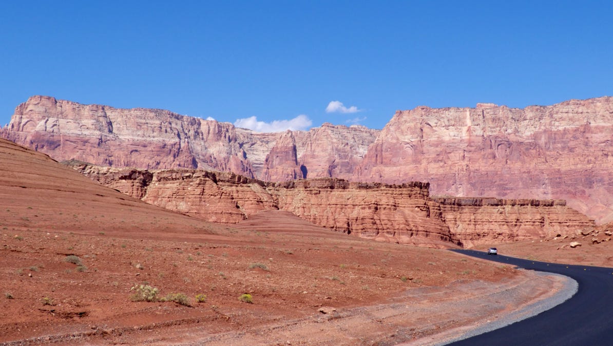
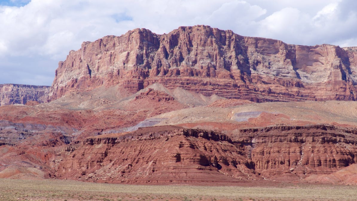
Our loop trip also allowed us to inspect the Vermillion Cliffs.
We were hoping to take a short cut back up to Utah on House Rock Road, but a ranger in Kenab we telephoned reported it was impassible due to water. So we pressed on to Fredonia, up to Kenab and then east on US 89, back to Big Water.
House Rock Road is at the red caution triangle on the map.
This photo was taken at the western end of the Vermillion Cliffs.
The highway to Fredonia was fairly curvy, and we went through a pine forest, up at 8,000 feet. We’d been on the road to Kenab a few days ago, so the drive wasn’t a surprise. It was a fairly fast trip back to our hotel.
A long, long drive to Lee’s Ferry and the Vermillion Cliffs.
The next day, we drove about 4 hours or so through Utah and Arizona (including infamous Colorado City) back to the Las Vegas airport for our flight home.