#22—Grand Lake’s Rose Garden
Walk #22—Grand Lake's Rose Garden
Saturday, 20 October 2012
It was a 64F and sunny at the start of the walk.
Here is a map of the walk (purple color). The blue pin is the start of the walk.
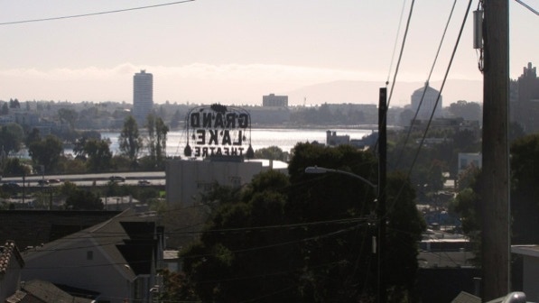
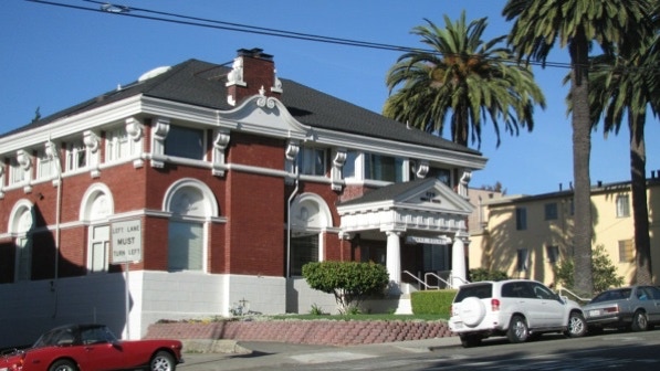
The Grand Lake Theater (1926) is owned by a fellow who uses the sign to inform people about his thinking on political issues.

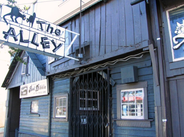
The Alley is mentioned on page 137. Rod Dibble has been at the piano bar for more than 50 years. It is definitely “divey” looking, but it does a good business.
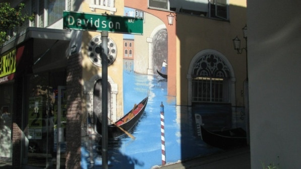
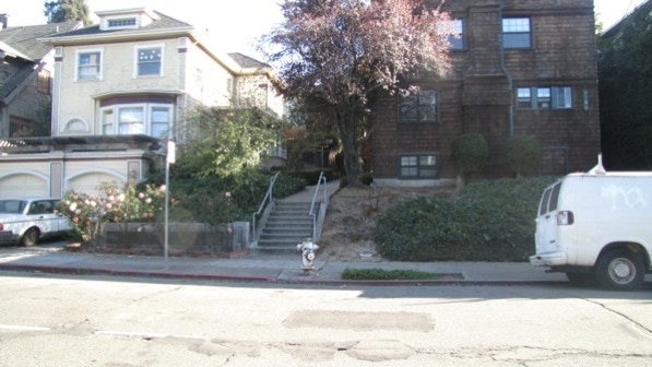
The right turn up Davidson Way is well–signed, plus there is a large Venetian mural up the way.
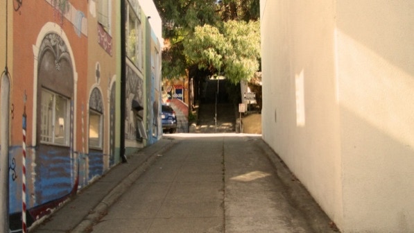
This is the beginning of Davidson Way, a ramp up to stairs.
Walker Avenue is at the top of the steps.
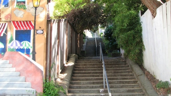
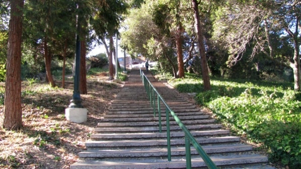
“...the upper half of Davidson Way climbs unsteadily up another 156 steps” (page 138).

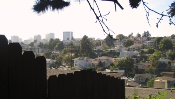
Up on Vermont Street, there are views of downtown Oakland, Lake Merritt and the Grand Lake Theater’s famous electric sign.
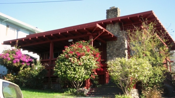
This is the “deep red Lincoln Log home at 990 (Vermont Street).”
This is a look down Fairbanks Avenue, toward the “complicated intersection where Fairbanks meets Boulevard Way, Sylvan Way, and Walker Avenue” (page 138).
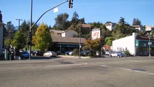
This view shows the intersection of Jean Street with Grand Avenue. The route goes to the left of the ACE sign. We are very close to the City of Piedmont here. On the map it is a gray line.
Here is the map again.
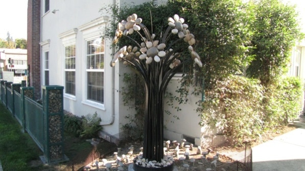
Page 139 mentions the “strange artistic expressions in stone” at the office at Jean Street and Grand Avenue. Those must be mushrooms at the base of the tree.
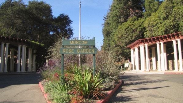
Not far up the street is the entrance to the Morcom Rose Garden with its “impressive Greek columns (page 140).”
The first time we took this walk, most of the garden was closed for renovations. It’s all open now, though.
This is the new staircase, just before the entrance. When you are at the top, you will have crossed over into Piedmont.

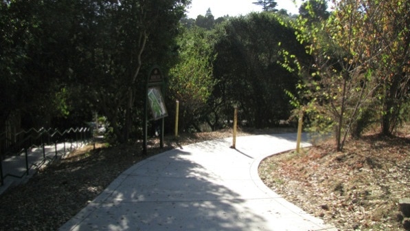
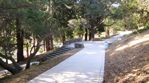
On page 140 the instructions are to take the “asphalt walkway” back down into the park. It is no longer asphalt. Here is a view of the path.
We went off route the first time we were here. We are confident the steps showing here going to the left are not on route, and that the proper route is to use the steps (hidden here) that are just to the left of the yellow structure.
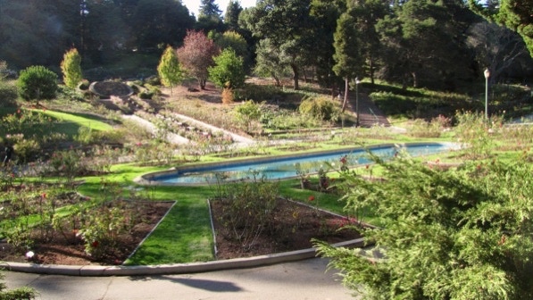
Here is the “lovely oval pond, framed in roses.”
At this point, we are at the flowing water pin on the map. The staircase up to Monte Vista Avenue is visible in the upper right section of the photo above. It is also new, and looks like this.
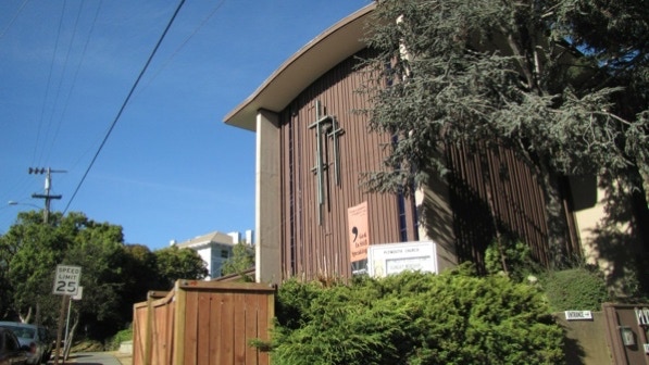
This is the “large (jazz and justice) Plymouth United Church of Christ” mentioned on page 140.

This is the “noble old home in need of restoration” next to the Plymouth Church. It looks like some work has been done since the book was published. The driveway on the left side is impressive.
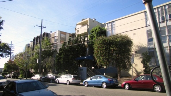
After turning onto Harrison Street, we saw examples of the large apartment houses found in this neighborhood.
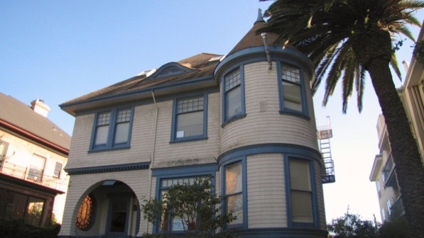
3912 Harrison Street is described as having a “comically conical roof” and a circular doorway. It was built in 1896.
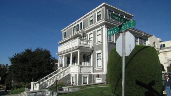
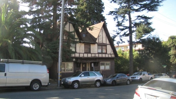
This house is at 126 Bayo Vista Avenue is in the book, “Locke House” (1911, John Hudson Thomas).
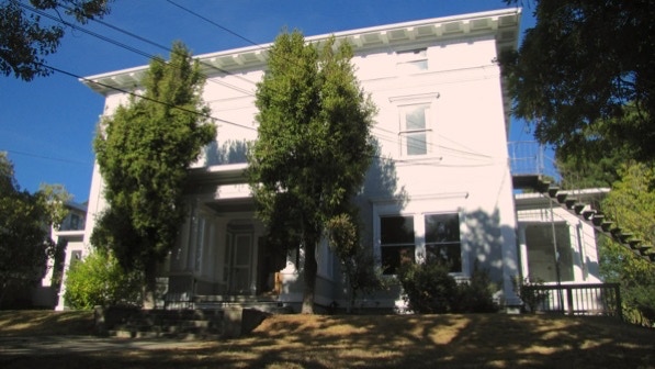
This is the “faded beauty” at 103 Bayo Vista Avenue.
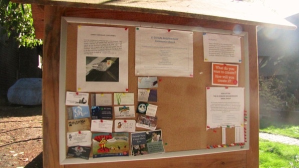
This message board on El Dorado Avenue isn’t mentioned in the book, and it is not on the Google street view (June 2011).
We hope the “lonely female cockatiel” (lost her companion two months ago) finds a new companion.
A sign pole with a lot of arrows pointing in many different directions.

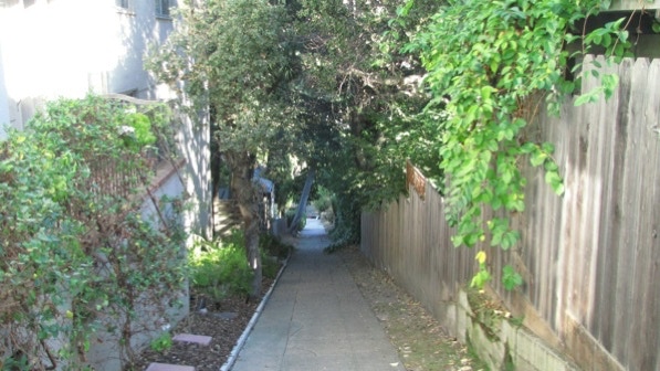
Looking down Oscar’s Alley.
At the other end, this is the view across Harrison Street. Be careful—there is no crosswalk to the staircase.
This must be “Towne House” (page 141).
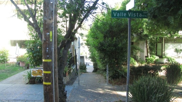
On Santa Rosa Avenue, between Vernon Street and Chetwood Street is a home with a circular window. We are a the red pin on the map.
We have worked our way down Santa Rosa Avenue, made three turns and are on Mira Vista Avenue. The entrance to Bonham Way isn’t well marked. It looks like this. Halloween isn’t far off!
The view down Bonham Way.
This is the continuation of the sloping walkway. Grand Avenue is at the other end.
On Grand Avenue, we turned right and walked back past the Alley to the starting point.
This is an good walk in an older area of Oakland. There are old houses to see and a lot of large apartment houses.
The book reports 461 steps and 2.4 miles. The step count is right, and the distance is 2.4 miles! (distance calculated by Google maps). Is this the first time the two estimates of distance match? If you are taking the bus, the ones to count on are 12, 57, 58X and the NL.
Next—Remillard Park, if the sun is out.