
Mount Cook National Park
Thursday—Friday February 19-20, 2015
We drove south from Kaikoura on Highway 1, and at Rangiora turned inland to skirt Christchurch. Our destination is the village of Twizel, close to Aoraki/Mount Cook National Park.
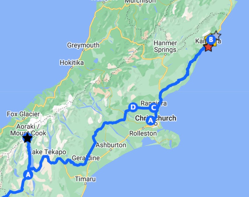


The full interactive map is at the bottom of this page. Kaikoura is the red star in the northeast, and the blue circle A is Twizel. F is the National Park.
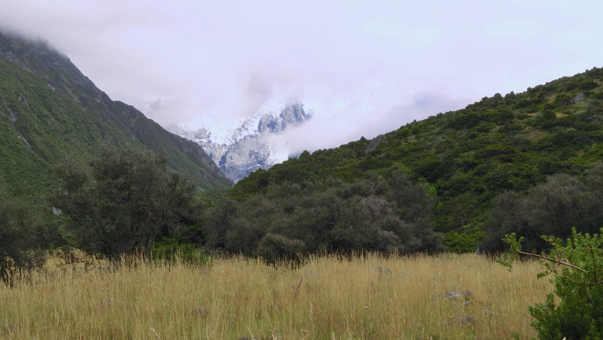
Friday morning we drove north along the shore of Lake Pukaki. We parked our car at the Visitor’s Center and started walking towards the mountains. Beautiful, but cloudy.
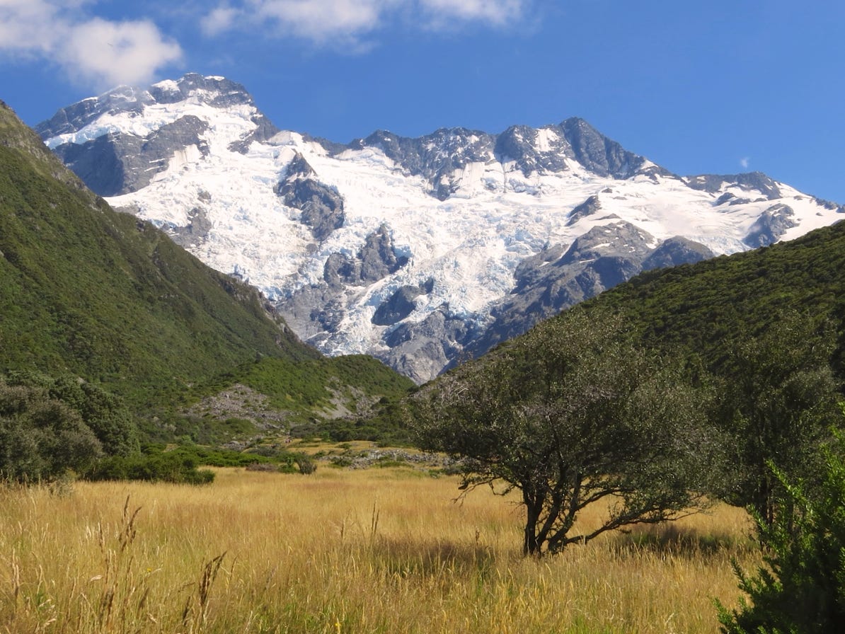
We kept walking and the clouds dissipated.
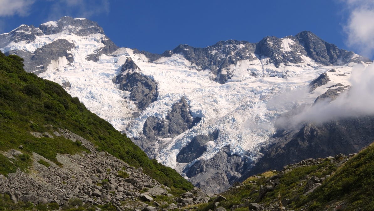
After more walking, we discovered we had not been looking at Mount Cook!

Here is a short video showing the area.
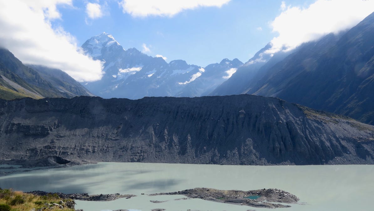
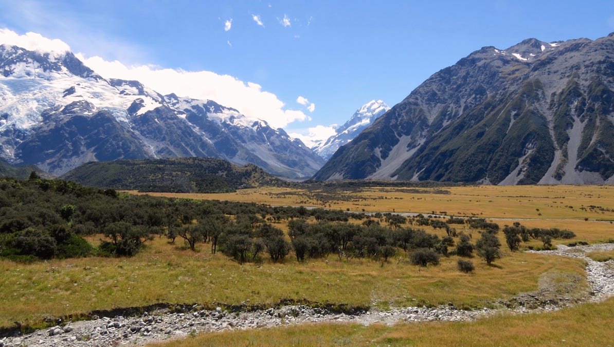
The views walking back to the Visitor’s Center were spectacular. Here’s one.

This is Blue Lake, with floating ice from the Tasman Glacier.


Beautiful!
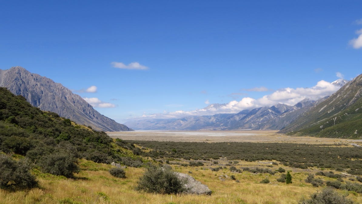
The view looking back towards Twizel takes in a huge valley.
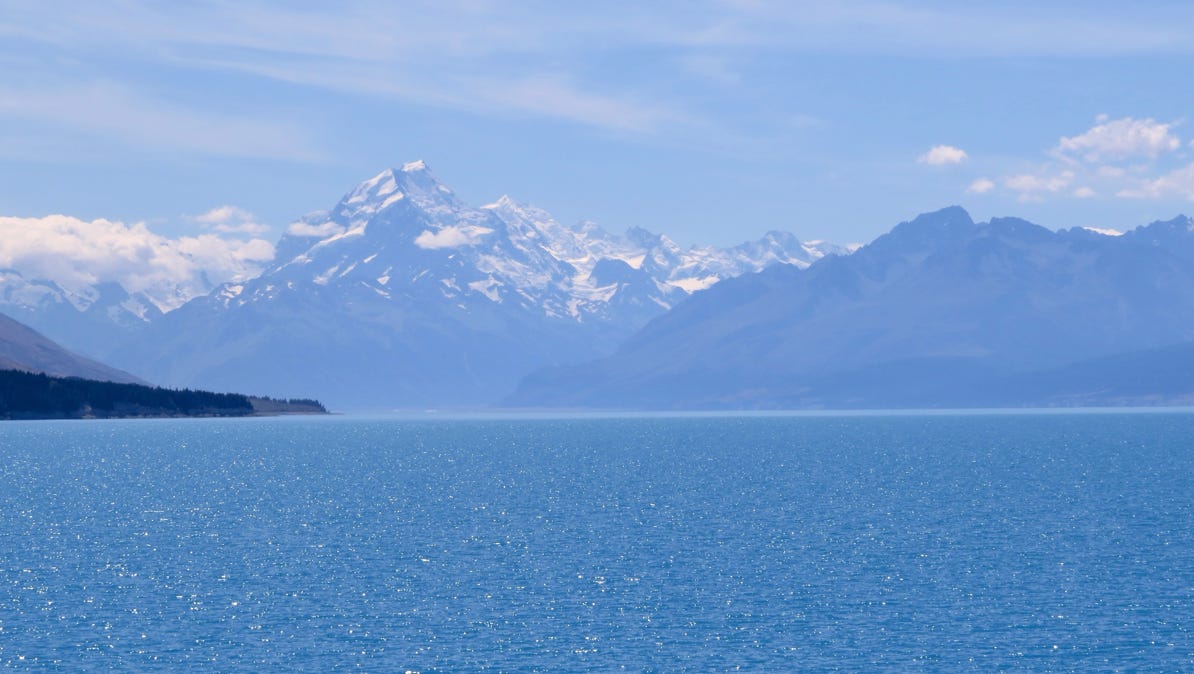
Before we got back to Twizel, we stopped for a look back at Lake Pukaki.
Here is the Google interactive map of our trip. Zoom in for detail of each area.
We drove down the coast from Kaikoura and after about two hours, turned inland, heading for the village of Twizel and nearby Aoraki/Mount Cook National Park.
Next—On to Dunedin.